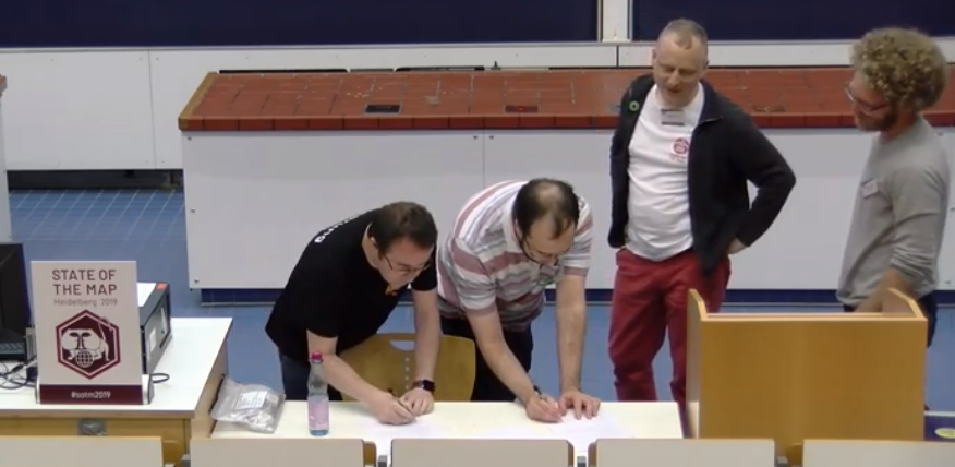
OpenStreetMap IrelandOpenStreetMap Ireland
  • Home
  • About
    • Membership
    • Corporate Members
    • Member Login
    • Who uses OpenStreetMap?
  • Learning
    • For Beginners
    • For Historians
      • How to fix wrong townland names spotted on townlands.ie
    • For Educators
    • For Developers
    • Tools
      • Mapillary street-level imagery
      • Panoramax Street-Level Imagery
      • OSMAnd Mobile App
      • Visualising Your Contributions
      • Using overpass-turbo to extract data from OpenStreetMap
  • Missions
    • AED Defibrillator Mapping
    • Current Mission Tasks
    • Completed Missions
      • Mapping Progress per County
      • Balbriggan
      • Celbridge
      • Connemara
      • County Cavan
      • County Clare – North
      • County Donegal
      • County Leitrim
      • County Roscommon
      • Longford Town
      • #MapLesotho
      • MapPatrick 2021
      • Wild Atlantic Way
  • News
  • LĂ©arscáil
  • Contact

Blog

OSMIE

Targets hit this week – 23rd December 2015

The OSM community have just surpassed the 47,000 townlands mark!  Earlier last week http://www.townlands.ie, stopped updating (new townlands stopped appearing as they were added).   After an investigation into the problem it was found that the database had grown so Read more

By OSM Ireland, 10 years ago
OSMIE

90 Young mappers and one flabbergasted older one!

My name is Dermot, and I’m a Mapaholic. I started adding bits of Ireland to OpenStreetMap early in 2007 and I haven’t stopped yet. When I started, there were pockets of coverage and a few interurban roads mapped. But basic things Read more

By OSM Ireland, 10 years14-Dec-2015 ago
Townlands

A few targets hit this week – 28th November 2015

Firstly congratulations to Stephen_Co_Antrim on achieving 10,006 townland’s!!  Given that there are approximately 64,000 townland’s in Ireland, he has completed about 1/6th of the Island all by himself!     Meanwhile townland coverage stands at 45,424 (74.3%) with County Monaghan Read more

By OSM Ireland, 10 years28-Nov-2015 ago
Uncategorized

Irish Vice Counties

I’ve been meaning to write about OpenStreetMap Ireland‘s townland mapping project for some time. It’s a wonderful example of how historical maps are of significant value in creating really useful data on OpenStreetMap which is just as relevant as it Read more

By OSM Ireland, 10 years16-Nov-2015 ago
Interviews

The Dublin Pub walk question….answered….again

  “Good puzzle would be cross Dublin without passing a pub,” muses Leopold Bloom in James Joyce’s classic novel Ulysses. Back in 2011, our own Rory McCann answered this question as reported in the Guardian and showed how it could be done Read more

By DaCor, 10 years ago
Townlands

Help translate townlands.ie

Townlands.ie is a project maintained by Rory McCann, which shows Ireland’s historic and current administrative divisions using data from OpenStreetMap.org and Logainm.ie. He has called for people to help translate the site into different languages.  Some of you using the Read more

By OSM Ireland, 10 years01-Nov-2015 ago
Meetups

HSE patient waiting list data – visualised by OSM Ireland and Open Knowledge Ireland

Back in June a number of OpenStreetMap Ireland mappers came together with Open Knowledge Ireland to help create an interactive dashboard on the current state of patient waiting lists in Irish hospitals. One of the people present on the day, Dan Read more

By DaCor, 10 years ago
Townlands

A few targets hits this week – 12th August 2015

Just a very short and quick post about townland mapping progress. In the last few days Louth (brianboru), Roscommon (NoelB) and Kilkenny (murtcostello) all hit 100% completion for townland coverage. The next county likely to finish is Dublin (brianh) in a Read more

By DaCor, 10 years12-Aug-2015 ago
Uncategorized

The bendiest roads in the world, by Rory McCann

Although created a long time ago, Rory’s work has popped up again, this time on Jalopnik. Check out the article here

By DaCor, 10 years ago
Website

Design competition for a new logo

So at the last meetup one thing everyone agreed was that we need to get moving on forming into a proper entity. Its something that has been spoken about off an on for the last 2 years and something which Read more

By DaCor, 10 years01-Jul-2015 ago
Meetups

2015 Meetup # 1 – Fingal County Council Offices, Swords

Sadly, due to lack of publicizing about this meetup and the relatively short notice given, turn out was pretty low for this event. However, the nature of the conversations and demo’s went to a deeper level due to the smaller Read more

By DaCor, 10 years28-Jun-2015 ago
Interviews

“State of OpenStreetMap in Ireland” interview

This post is copied from the OpenCage Data Blog   Today we continue our country profile interview series, this time chatting with Dave Corley about OpenStreetMap in Ireland. Things have come a long way since SotM 2008 was held in Read more

By OSM Ireland, 11 years01-Nov-2014 ago

Posts pagination

Previous 1 … 4 5
Recent Posts
  • OpenStreetMap Ireland Annual General Meeting
  • OSM 21st Birthday Online Mapathon
  • OpenStreetMap Ireland online meetup – May 2025
  • Louth (minus Dundalk) Task Mapped
  • Dundalk Task Complete
Upcoming Events (Global)
  • MapatĂłn Nacional de MĂ©xico 2025
  • SotM LatAm 2025
  • Mappy Hour OSM España
  • UN Mappers #ValidationFriday Mappy Hour
  • OSMF Engineering Working Group meeting
  • A Synesthete’s Atlas: Performing Cartography, an Artist Talk with Eric Theise
  • Workshop - Mobile Mapping for OpenStreetMap
OSM for History Buffs
  • Inistioge Cloister Reconstruction
  • Medieval grave slab discovered #medieval #kilkenny
  • St Brigid's Well, Ballintubbert (Co. Laois)
  • Holy wells and OpenData - a talk about Wikidata et al.
  • Easily add mapillary ID to node
Forum Discussions
  • OpenStreetMap Ireland Annual General Meeting 2025
  • Northern Ireland county vs new council boundaries
  • N21 to N20 junction at Patrickswell, Limerick
  • NI charity numbers
  • Boundaries in Ireland

OpenStreetMap Ireland Company Limited Registered company number 638034

General
  • Log in
  • Entries feed
  • Comments feed
  • WordPress.org
Categories
Archives

  • Home
  • About
  • Learning
  • Missions
  • News
  • LĂ©arscáil
  • Contact
Hestia | Developed by ThemeIsle

OpenStreetMap Ireland Cookies Policy

Our Website uses cookies to improve your experience. Please visit our Privacy Policy page for more information about cookies and how we use them.

Close