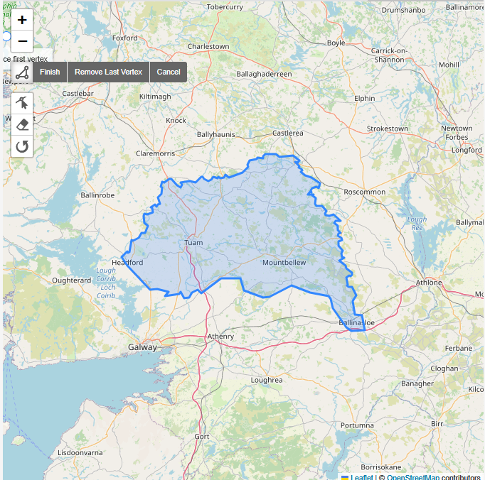
March 25th 2023 saw the final touches on the Roscommon task, that is the mapping stage was completed; validation is still required. It had first been created in August of 2022, but the bulk of attention was given to it this year. Newish and clear Bing imagery was available for most of the county. Bing had not been updated on a small strip on the Eastern border, and Esri Clarity was used as the fallback.
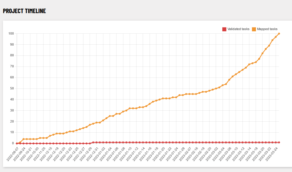
It was also the first task we mapped using the new task manager, thanks to Jonny McCullagh and Colin Broderick who performed the migration. It gives the mapper access to fancy statistics, even though it might take some time to get used to the new interface. However, the more you use it, the easier it gets 😉
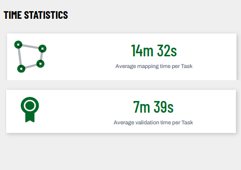
Using the average mapping and validation time for the tasks, it estimates the remaining time needed for mapping and validation. However, the average time is easily off by the occasional mapper opening a task and forgetting to close it, once they give up or finish.
Guest mappers
Towards the end of the mapping process, some new mappers joined in. It turned out they were college students from University College Cork, sent by their lecturer Shawn Day. The students continued arriving and flowed over into the Longford town task which is near completion as of the time of writing. Maybe we will hear more from them about their project?
How many buildings were mapped?
According to ohsome.org, the following distribution of buildings were mapped between August 7 2022 and March 19 2023:
| building type | increase since 2022-08-07 | no. 2023-04-07 |
|---|---|---|
| building | 52,100 | 81,100 |
| building=yes (to be avoided, if possible!) | 19,100 | 31,000 |
| building=house | 19,100 | 29,400 |
| building=terrace | 94 | 105 |
| building=detached | 4 | 277 |
| building=shed | 3,481 | 4.400 |
| building=garage | 2,987 | 4,300 |
| building=greenhouse | 255 | 366 |
| building=farm_auxiliary | 5,691 | 8,900 |
| building=school | 39 | 129 |
| building=church | 23 | 93 |
| building=retail | 43 | 100 |
| building=commercial | 17 | 78 |
| building=industrial | 12 | 134 |
| building=ruins | 623 | 1,200 |
Highways
The number of highways increased by 45.7% to 19,000 km since August 2022.
Landuse
| Landuse Type | Area Increase (in km2 since Aug 2022) |
| natural=wetland | 79.8 |
| landuse=forest | 28.7 |
| landuse=residential | 0.9 |
| natural=wood | 0.7 |
| landuse=grass | 0.146525 |
| landuse=farmland | 0.8 |
Historic features
Roscommon has many lakes and wetland which makes it very interesting for someone looking for crannógs – who would that be now? Twelve hitherto ‘unknown’ crannógs were discovered and will be reported to the National Monuments Service.
There are also areas with many drystone walls, and there seemed to be many more-or-less ancient field systems. The wiki page for field systems was created as a result of that, and a video was published by myself about how to map them and what features can be found in them.
| Historic Feature | Number (as of March 27 2023) |
ringfort | 1633 |
tumulus (i.e. barrow) | 54 |
field_system | 42 |
| crannóg | 71 |
megalith | 23 |
holy well | 37 |
castle | 22 |
Validation
For those validating the tasks, the number of tags for building=yes could be be improved by using more precise tags.
1 Comment
Longford Town Task Finished – OpenStreetMap Ireland · 21-Mar-2024 at 09:30
[…] because the large choice of tasks hindered the completion of any of them. It was revived after the completion of the Roscommon task and finished within less than a week. The best quality imagery was Esri Clarity which is however […]
Comments are closed.