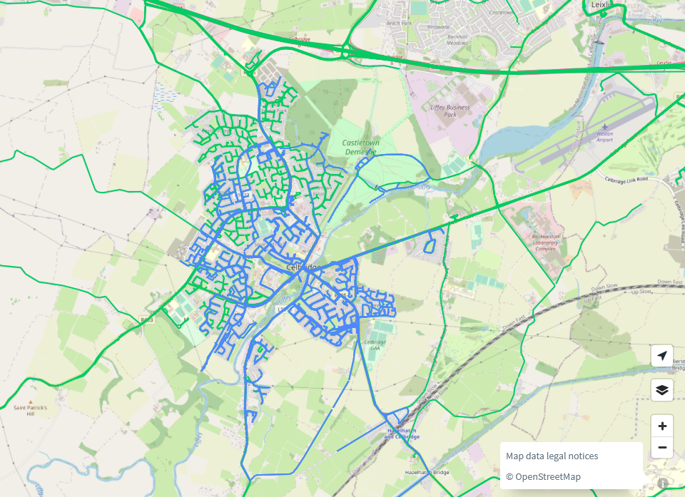
The project to map all buildings in Celbridge was an initiative by the Celbridge Community Council back in 2021. The task was finished relatively quickly due to the good participation. At the beginning of April, local resident and mapper Stephen had requested to have the Celbridge 2 task re-activated, and of course we obliged.
The task instructions asked for micro-mapping as regards to barriers, highways, street furniture, and also asked to make sure landuses did not overlap. The mapping stage was finished by May 12th, but validation is still required.
There were 20 contributors (20 mappers & 6 validators) to the task as of May 22nd.
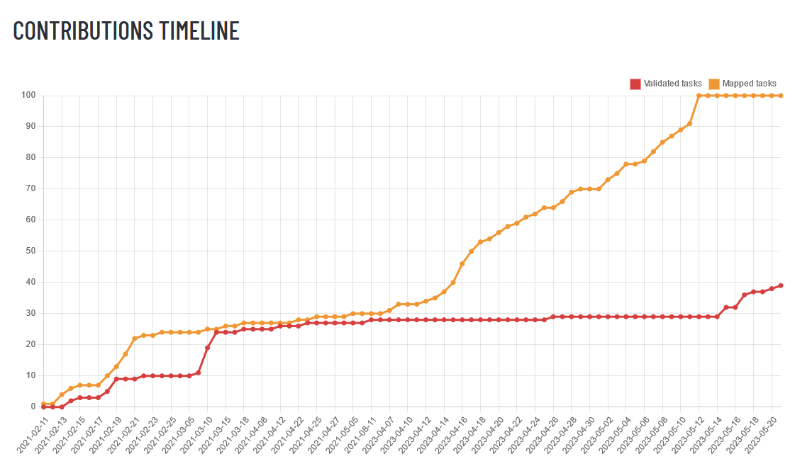
Some statistics
The task was primarily not about buildings, but there had been so much building activity since 2021, that it was necessary to also add new and possibly previously overlooked buildings. This goes to show that a task is never really finished, but unfortunately we do not have the resources to revisit every task every two years to update the map.
| building types | April 4th 2023 | May 14th 2023 | post validation |
|---|---|---|---|
| buildings in total | 8,600 | 9,600 | 9,600 |
| yes | 741 | 580 | 438 |
| house | 4,200 | 3,900 | 3,400 |
| apartments | 8 | 9 | 38 |
| semidetached_house | 2,100 | 2,200 | 2,800 |
| detached | 87 | 440 | 792 |
| terrace | 130 | 1651 | 0 |
| residential | 90 | 118 | 100 |
| construction | 10 | 1192 | 135 |
| shed | 629 | 1,100 | 2,100 |
| garage | 263 | 346 | 398 |
| greenhouse | 24 | 50 | 58 |
| bank | 1 | 1 | 1 |
| public | 2 | 2 | 4 |
| hotel | 2 | 3 | 4 |
| commercial | 76 | 80 | 90 |
| industrial | 18 | 49 | 55 |
| retail | 16 | 19 | 29 |
| office | 7 | 6 | 6 |
| school | 24 | 35 | 35 |
| church | 3 | 3 | 3 |
| hospital | 1 | 1 | 28 |
| farm_auxiliary | 116 | 236 | 252 |
| ruins | 4 | 8 | 11 |
1 Should be split or retagged into house: http://overpass-turbo.eu/s/1vdk
2 Check again in some months time to update: http://overpass-turbo.eu/s/1vd9
Interpretation of numbers: As Celbridge grows, the number of buildings grows with it. The number of building=yes was reduced as required in the task, but could be reduced by local mappers even more. The mantra here is, as always “A mapper’s work is never done.” However, there is great detail mapped in Celbridge now.
Other improvements via the task
Celbridge is one of the few towns in Ireland with dedicated mappers on the ground which improves the quality of the map immensely. A lot can be done using mapillary, but information like house numbers and business names are much easier done and kept up-to-date by locals. Obviously, it would be much easier to get this data from the government, as is possible in other countries, but until then, it will all have to be done manually using StreetComplete, EveryDoor or OSMAnd.
| tag | April 4th 2023 | May 12th 2023 | post validation |
|---|---|---|---|
addr:housenumber | 1,700 | 1,700 | 1,800 |
addr:housename | 24 | 25 | 17 |
addr:street | 1,800 | 1,900 | 2,400 |
barrier=hedge | 71.3 km | 138 km | 142 km |
barrier=fence | 8.4 km | 26.5 km | 28.1 km |
barrier=wall | 36.3 km | 72.2 km | 124 km |
highway=street_lamp | 664 | 1,100 | 1,600 |
+ ref | 116 | 116 | 119 |
amenity=bench | 31 | 31 | 34 |
amenity=waste_basket | 50 | 50 | 50 |
amenity=post_box | 8 | 8 | 8 |
amenity=bicycle_parking | 33 | 33 | 34 |
natural=tree | 2,400 | 15,400 | 20,500 |
genus/ genus:en | 3 + 1 | 23 + 1 | 27 + 21 |
natural=tree_row | 5.3 km | 10 km | 30.6 km |
waterway + tunnel=yes | 714.1 m | 713.8 m | 699.4 km |
The task definitely made a difference for the mapping of barriers and trees. It is impossible to say remotely, if maybe all the benches, postboxes and benches were mapped already before the task, and if that is the reason why there is (almost) no increase.
Mapillary
Celbridge has very good coverage on Mapillary, an honourable mention is due for TSFX who is tirelessly capturing Mapillary all over Celbridge which is helping remote mappers as well as local mappers. Other Mapillary users like yannakis have also contributed a great deal.
Action items for local mappers
Using your local knowledge in Celbridge, try to reduce building=yes further, either by using StreetComplete walking around or working from home.
Construction sites should be checked regularly (every 6 months or so) to update the map without having to rely on aerial photography.
One of the ideas by the local community was to map street lights with their reference numbers to make it easier to report malfunctioning ones to the council. The number of street lights mapped is already exemplary, however, the references need to be added. EveryDoor should be able to deal with that; OSMAnd unfortunately does not show street lights.
Action items for remote mappers
addr:street can be added remotely, leaving addr:housenumber to local mappers.
Thanks to everyone for their contributions!