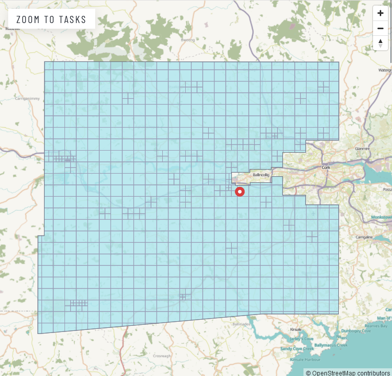
There have been attempts to map the buildings in the very large county of Cork for a while; parts were covered by the WildAtlanticWay efforts, and other tasks for Cork had been created. This one focused on the area roughly between Macroom and Cork (leaving out Cork city), because it was covered by the 2021 Bing imagery, whereas other parts of Co. Cork were not.
The task was opened on January 25th 2024 and finished (only the mapping, mind, validation is still outstanding) on February 24th 2024. (I had the audacity to go on holidays in between, hence the dip in the curve.) Three mappers worked on the task:
- b-unicycling with 754 tasks
- DIrish with 3 tasks and
- TXPEig with 3 tasks

Results in numbers
| building type | No. Jan 24th 2024 | No. Feb 24th 2024 |
|---|---|---|
* | 28.4K | 55.6K |
yes | 9.7K | 14K |
house | 12.1K | 22.9K |
semidetached_house | 134 | 1.2K |
terrace | 119 | 62 |
detached | 275 | 980 |
residential | 285 | 40 |
farm | 15 | 55 |
farm_auxiliary | 3K | 10.5K |
shed | 147 | 661 |
garage | 1.7K | 3.4K |
greenhouse | 82 | 226 |
barn | 5 | 6 |
commercial | 35 | 82 |
retail | 52 | 242 |
church | 39 | 54 |
school | 107 | 76* |
public | 35 | 18** |
hangar | 6 | 7 |
ruins | 126 | 448 |
building=school.** Someone had mapped quite a few houses as
building=public.Other things added to the map
| tag | No. Jan 24th 2024 | No. Feb 24th 2024 |
|---|---|---|
historic=* | 673 | 977 |
megalith_type=menhir* | 0 | 81 |
megalith_type=stone_circle | 2 | 14 |
megalith_type=stone_row | 0 | 10 |
waterway=stream | 290km | 343km |
highway | 4,566km | 4,993km |
parking_space=disabled | 9 | 89 |
highway=street_lamp | 87 | 145 |
highway=crossing | 240 | 277 |
highway=stop | 210 | 290 |
traffic_calming=table | 9 | 25 |
bridge=yes | 357 | 375 |
ford=yes | 6 | 14 |
Thanks to DIrish and TXPeig for helping and happy validating!