This issue arises frequently in our Facebook group when people “report” a wrongly spelled townland name on townlands.ie which, of course, gets its data from OpenStreetMap. The error cannot be fixed on townlands.ie directly, but has to be fixed in the OSM database on openstreetmap.org.
What causes the mistakes?
Before we get into the how to fix it (and you can skip the next part, if you don’t care about the how and why), why did these mistakes end up on townlands.ie? As per usual, this data was not provided by the Irish government as open data, so the mappers involved back in the day (I wasn’t personally involved at the time) used scans of the paper British War Office map also known as GSGS 3906. If you are old enough to remember paper maps, you will be aware that certain things on those maps overlapped, because you couldn’t just disable certain layers. Therefore, one of the reasons for wrongly spelled names of townlands is that some other feature (usually a grid line) covered up a letter and it was misinterpreted. The scans are also not of the best quality, so sometimes the names are just difficult to read because of that. Then also, this work was done by human volunteers, and humans make mistakes. We usually don’t read a word letter by letter, but take a glance and think we know the word and read it that way. But that doesn’t really work for Irish place names; they do be tricky. Someone might have “read” a townland name in a way that was similar to a place name they knew from their area, but one letter can make all the difference. Lastly, it could just be typos, and without an established ant thorough way of quality control, they might never be found. Systematically adding the logainm:ref or wikidata to each townland would be a way – just saying…
How to edit townland names on openstreetmap.org
Before you decide to edit anything in the OSM database, be aware that it is used by many, many people and institutions, and that your changes will have an effect on them. This should make you proud of your contribution, but also aware of consequences. Don’t let that stop you, though.
If you don’t have a user account on openstreetmap.org, go and get that first. It is free, and there are no cookies. Log in. This tutorial will presume that you are a beginner and will therefore use the iD editor.
Step 1: Identify the mistake and find on openstreetmap.org
You have likely already found a candidate on townlands.ie. Just scroll to the bottom of its entry and click on the iD editor button.
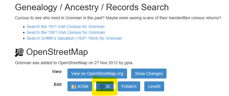
If you weren’t logged in yet, you might have to do that first.
Step 2: Look at the tags
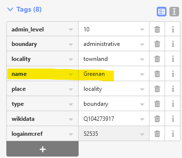
On the left hand side menu, you should see a list of tags which includes admin_level=10, identifying this relation as a townland, the type of relation which is boundary etc.
A relation is a collection of features which share a purpose. This can be a boundary (which is usually shared with its neighbour), a waterway, a route etc.
A lot of the townlands also already have their wikidata identifier added.
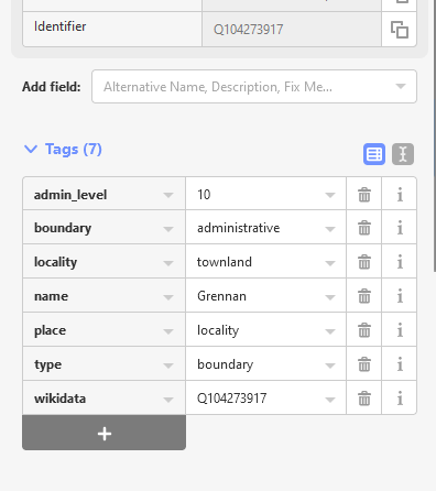
The tag you are interested in is the name tag. Before you rush in and correct the spelling, have a look at the British War office map.
Step 3: Check spelling on British War Office map/ GSGSG 3906
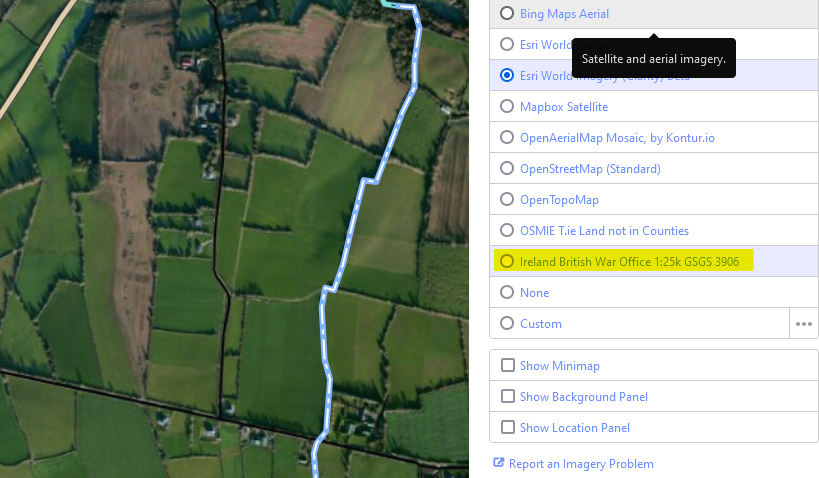
To activate that background layer, go to the right hand side menu, specifically the Background Settings.
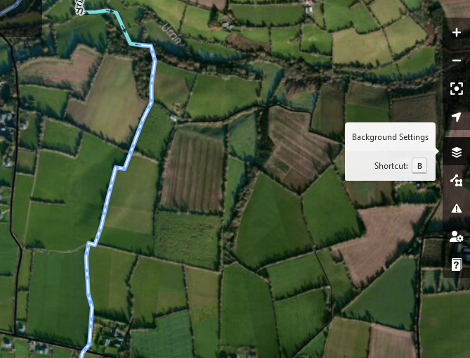
Activate the British War Office map.
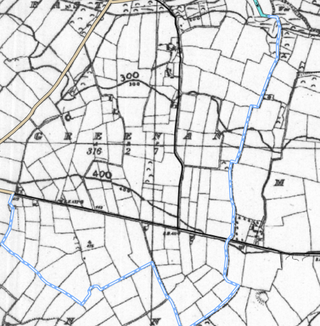
Double-check the spelling there, if you can read it:
Step 4: Go back to the tags and correct the spelling there.
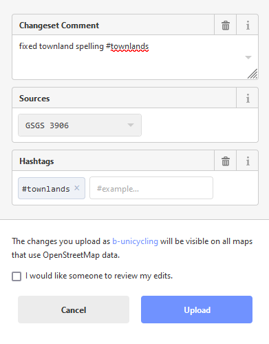
Step 5: Save your change(s)
In the top right corner, you should see a button with an upload symbol and a “1” next to it, signifying that you made one change. Click on that to upload.
Add your changeset comment and source. You may want to use the hashtag #townlands. If you are unsure about your change, tick the box that you want someone to review your edit. Hit “Upload”.
Sin é bhfuil.
If you are advanced enough to use the JOSM editor, you can also use the first and second edition Ordnance Survey maps as background layers to check the spelling. The scans are newer and of much better quality. Be aware that the townland boundaries themselves might have changed between these editions and don’t try to correct the actual boundaries according to these outdated maps!