OpenStreetMap IrelandOpenStreetMap Ireland
  • Home
  • About
    • Membership
    • Corporate Members
    • Member Login
  • Learning
    • For Beginners
    • For Historians
    • For Educators
    • For Developers
    • Tools
      • Mapillary
      • OSMAnd Mobile App
      • Visualising Your Contributions
  • Missions
    • AED Defibrillator Mapping
    • Current Mission Tasks
    • Completed Missions
      • Connemara
      • County Cavan
      • County Donegal
      • County Leitrim
      • County Roscommon
      • Longford Town
      • #MapLesotho
      • MapPatrick 2021
      • Wild Atlantic Way
  • News
  • Contact

History

History

Crannogs Discovered in County Cavan

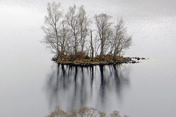
Prolific mapper b-unicycling has recently been acknowledged in the Kilkenny People for her discoveries of previously unrecorded crannogs. Anne-Karoline Distel discovered the crannogs while mapping the County Cavan task, reporting them to the National Monuments Service. This discovery adds to her previous finds of enclosures in County Tipperary in May Read more…

By Jonny McCullagh, 6 months25-Nov-2022 ago
Recent Posts
  • Connemara Task Finished
  • Map & Chat April: Maynooth
  • Leitrim Task Fully Validated
  • Longford Town Task Finished
  • Roscommon Task Finished
Upcoming Events (Global)
  • Alluvione dell'Emilia-Romagna: editathon e mapping party al Salaborsa Lab
  • Mapea por Mosquera
  • Resolución de notas en tiempo real - Real-time note resolution
  • MapRoulette Nights
  • MapRoulette Monthly Community Meeting
  • Missing Maps London Mapathon
  • South Bay Map Night
OSM for History Buffs
  • Tracking down milk churn stands in Latvia
  • Mapping urine deflectors on OpenStreetMap
  • Milk churn stand recording on OpenStreetMap (Version 2)
  • Recording milk churn stands to Wikimedia
  • Adding a milk churn stand using OSMAnd
Forum Discussions
  • Debugging help - Mourne, Gullion & Strangford UNESCO Global Geopark boundary
  • Northern Ireland 'super-council' boundaries
  • State of the Map Europe 2023 - invitation
  • TomTom MapRoulette challenge
  • Standardize on not including “River” in the `name` tag for rivers?

OpenStreetMap Ireland Company Limited Registered company number 638034

General
  • Log in
  • Entries feed
  • Comments feed
  • WordPress.org
Categories
Archives

  • Home
  • About
  • Learning
  • Missions
  • News
  • Contact
Hestia | Developed by ThemeIsle

OpenStreetMap Ireland Cookies Policy

Our Website uses cookies to improve your experience. Please visit our Privacy Policy page for more information about cookies and how we use them.

Close