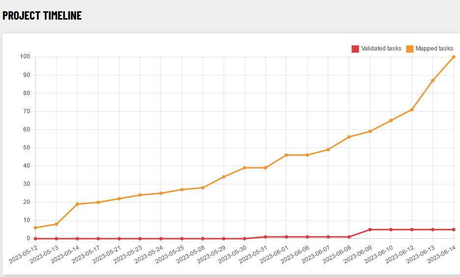
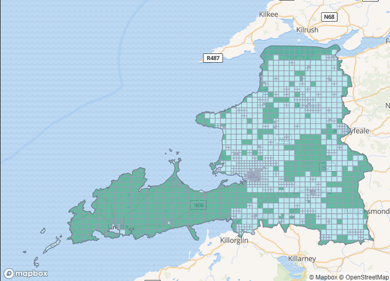
Since we are depending on the very patchy distribution of new Bing aerial imagery, it was decided to only map the Northern part of Co. Clare in a task which was newly created. This consisted mostly of The Burren, so not too many buildings were expected. The task was started on May 12th, and the mapping stage was finished by June 14th. There were 4 contributors in total up to that point, possibly the lowest number for any task so far.
Progress on mapping buildings
| building type | no. before task | no. June 14th | no. post validation |
|---|---|---|---|
building | 2,500 | 7,300 | |
yes | 1,400 | 1,800 | |
house | 711 | 2,600 | |
detached | 16 | 98 | |
semidetached_house | 4 | 4 | |
terrace | 18 | 0 | |
garage | 50 | 409 | |
shed | 75 | 788 | |
greenhouse | 0 | 74 | |
public | 2 | 4 | |
school | 7 | 16 | |
retail | 22 | 56 | |
commercial | 10 | 34 | |
hotel | 3 | 35 | |
industrial | 3 | 5 | |
farm_auxiliary | 40 | 902 | |
barn | 29 | 32 | |
church | 7 | 10 | |
ruins | 39 | 371 |
Since most land cover in the task was natural=bare_rock with very few houses, mapping dry stone walls and other things was a welcome alternative to closing tiles without any edits.
Other Things Mapped
| tag | no./ length before task | no./ length June 14th | no./ length after validation |
|---|---|---|---|
wall=dry_stone | 114 km | 739km | |
place_of_worship=holy_well | 5 | 9 | |
fortification_type=ringfort | 163 | 341 | |
archaeological_site=enclosure | 0 | 23 | |
natural=tree | 14 | 280 |
1 Comment
Diarmuid · 06-Jul-2023 at 14:59
well done – that was a major effort ..
Comments are closed.