OpenStreetMap IrelandOpenStreetMap Ireland
  • Home
  • About
    • Membership
    • Corporate Members
    • Member Login
    • Who uses OpenStreetMap?
  • Learning
    • For Beginners
    • For Historians
      • How to fix wrong townland names spotted on townlands.ie
    • For Educators
    • For Developers
    • Tools
      • Mapillary street-level imagery
      • Panoramax Street-Level Imagery
      • OSMAnd Mobile App
      • Visualising Your Contributions
      • Using overpass-turbo to extract data from OpenStreetMap
  • Missions
    • AED Defibrillator Mapping
    • Current Mission Tasks
    • Completed Missions
      • Mapping Progress per County
      • Balbriggan
      • Celbridge
      • Connemara
      • County Cavan
      • County Clare – North
      • County Donegal
      • County Leitrim
      • County Roscommon
      • Longford Town
      • #MapLesotho
      • MapPatrick 2021
      • Wild Atlantic Way
  • News
  • LĂ©arscĂĄil
  • Contact

Burren

OSM Ireland Buildings

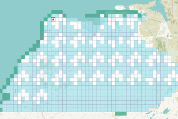
North Co. Clare Finished

Since we are depending on the very patchy distribution of new Bing aerial imagery, it was decided to only map the Northern part of Co. Clare in a task which was newly created. This consisted mostly of The Burren, so not too many buildings were expected. The task was started Read more…

By Anne-Karoline, 2 years05-Jul-2023 ago
Recent Posts
  • OpenStreetMap Ireland online meetup – May 2025
  • Louth (minus Dundalk) Task Mapped
  • Dundalk Task Complete
  • How to fix wrong townland names spotted on townlands.ie
  • Panoramax Street-Level Imagery
Upcoming Events (Global)
  • “Facciamo Luce” sulla mappa di Milano
  • [Online] Map-py Wednesday
  • State of the Map Croatia 2025
  • Stammtisch Karlsruhe
  • Cartopartie Ă  Bayonne
  • OSM-Stammtisch Hannover
  • OpenStreetMap Community Meet-Up - Istanbul
OSM for History Buffs
  • Searching old street names in OpenStreetMap
  • From gravestone to 3D model - photogrammetry and heritage
  • St Moling's Well Listerlin
  • Rathlogan: Tobar na sĂșil
  • Kiltrassy Church Well
Forum Discussions
  • Missing Post Offices in Northern Ireland
  • Ireland – Fix Incorrect Highway Junctions
  • Finding broken relations with Overpass
  • Ireland - Fix Spiky Buildings (updated)
  • Relation breakage (on the coastline) northeast of Swords

OpenStreetMap Ireland Company Limited Registered company number 638034

General
  • Log in
  • Entries feed
  • Comments feed
  • WordPress.org
Categories
Archives

  • Home
  • About
  • Learning
  • Missions
  • News
  • LĂ©arscĂĄil
  • Contact
Hestia | Developed by ThemeIsle

OpenStreetMap Ireland Cookies Policy

Our Website uses cookies to improve your experience. Please visit our Privacy Policy page for more information about cookies and how we use them.

Close