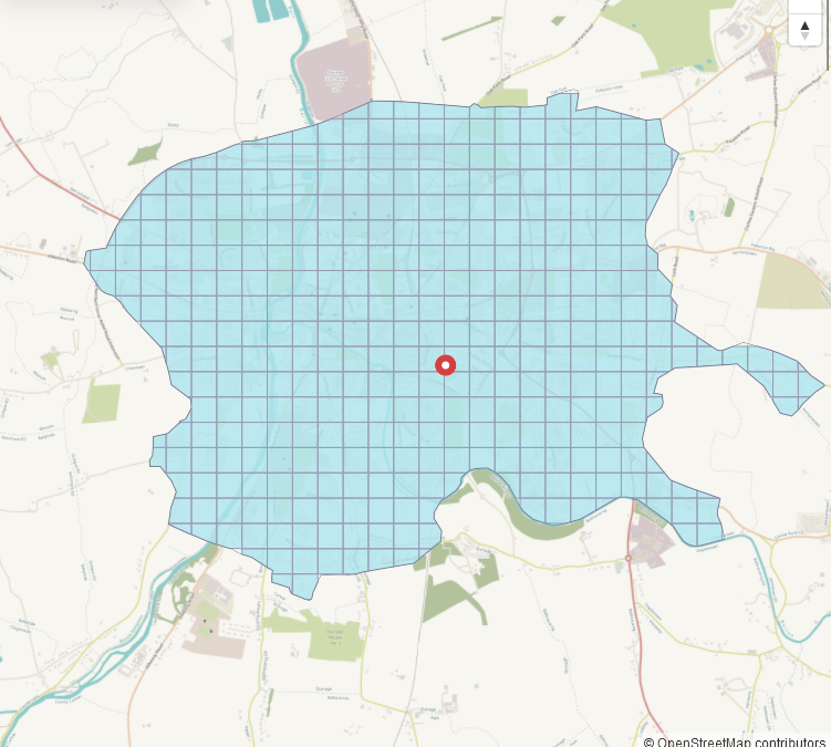
The Northeast Kildare task had been reopened on September 9th 2024, and the mapping process was completed (apart from re-mapping after invalidation) on October 24th 2024.

Six mappers worked on the task (b-unicycling, jmkie, DeBigC, Ivandor, IpswichEdits & peterm7), and so far, one person (craghead) has started the validation process. A huge THANK YOU to all involved.

The area is of course popular with commuters working in Dublin, so there is a lot of building activity which we should try to keep up with. This task included the areas of Celbridge and Maynooth which had had their own tasks before, Celbridge even twice.
Buildings statistics*
Building types
* I did not have the outline, so I had to use a hand-drawn bounding polygon instead, but it’s the same for all dates.
| building tag | no. 2020-01-01 | no. 2024-05-01 | no. 2024-11-01 |
|---|---|---|---|
| * | 8,800 | 39,800 | 55,000 |
yes | 4,400 | 5,100 | 6,100 |
house | 3,800 | 17,700 | 37,700 |
detached | 59 | 1,900 | 0 |
terrace | 46 | 170 | 46 |
apartments | 71 | 225 | 455 |
residential | 133 | 417 | 176 |
garage | 9 | 806 | 2,300 |
shed | 15 | 2,800 | 4,200 |
greenhouse | 16 | 89 | 184 |
farm_auxiliary | 2 | 456 | 2,200 |
barn | 9 | 19 | 19 |
stable | 29 | 46 | 72 |
retail | 23 | 129 | 216 |
commercial | 0 | 167 | 272 |
industrial | 59 | 172 | 183 |
hotel | 4 | 15 | 14 |
public | 7 | 20 | 20 |
school | 51 | 90 | 86 |
church | 12 | 31 | 36 |
ruins | 4 | 40 | 109 |
Building sub tags
Once buildings are mapped, building details such as roof shape, building levels and addresses can be added. Lets have a look:
| sub tag | no. 2020-01-01 | no. 2024-05-01 | no. 2024-11-01 |
|---|---|---|---|
building:levels | 815 | 8,600 | 8,800 |
roof:shape | 30 | 7,200 | 7,300 |
entrance=* | 28 | 123 | 163 |
addr:housenumber | 1,200 | 4,200 | 4,600 |
addr:housename | 52 | 134 | 198 |
addr:street | 3,100 | 14,500 | 16,300 |
Ideally, there should really be an equal number of housenumber and housename combined compared to addr:street, which is far from equal.
Other features of note
| tag | 2020-01-01 | 2024-11-01 |
|---|---|---|
waterway=* | 191km | 227km |
highway=* | 1608km | 2346km |
leisure=pitch + sport=equestrian | 4 | 154 |
leisure=pitch + sport=tennis | 38 | 93 |
highway=crossing | 188 | 2,200 |
traffic_calming=* | 301 | 549 |
amenity=parking | 784117.5 ㎡ | 1.0 ㎢ |
landuse=grass | 2.4 ㎢ | 3.1 ㎢ |
natural=tree | 428 | 23,200 |
leisure=playground | 16437.9 ㎡ | 15849.9 ㎡ |
emergency=defibrillator* | 12 | 31 |
* Not visible on satellite imagery, of course, but easier to map the location of, when the building is mapped.
All in all, this is probably a task we will have to revisit in 3-7 years time. Some of this can already be covered by validators. Click here to validate.


