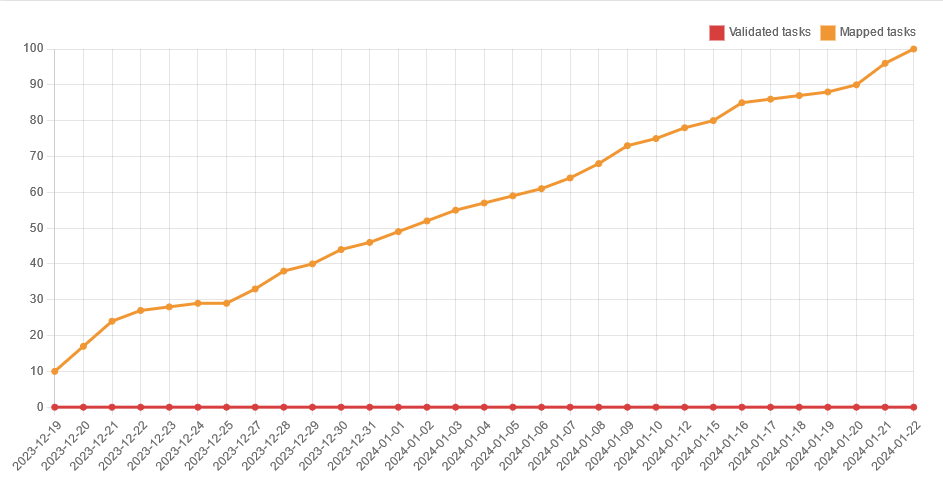
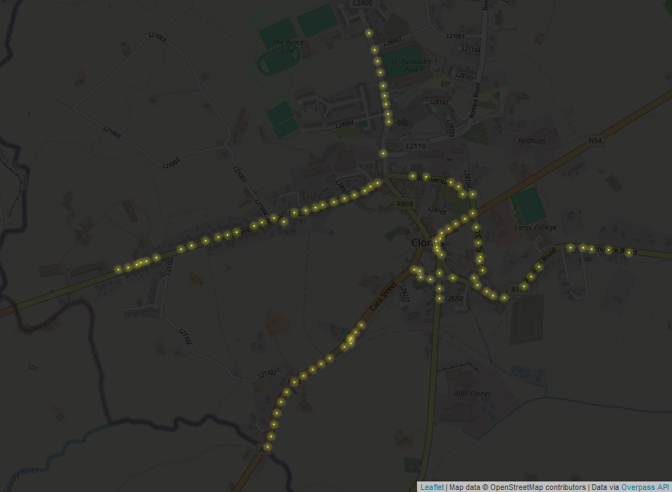
As task no. 100, I created one for County Monaghan after a certain person complained that it had been neglected so far. It was created as a private task that only team members could work on (whoever “the team” is), because I wanted to look for unrecorded archaeological sites and have no-one disturb my turf. Jonnymccullagh managed to map a few tiles anyway. I started on December 19 and finished on January 22nd. Eight potential crannógs were discovered and reported to the National Monuments Service.
The Numbers
| building type | no. before task | no. Jan 23rd 2024 |
|---|---|---|
yes | 3,700 | 19,004 |
house | 5,100 | 21,915 |
semidetached_house | 554 | 2,230 |
detached | 215 | 506 |
terrace | 111 | 70 |
residential | 51 | 17 |
shed | 439 | 2,423 |
garage | 285 | 2,906 |
farm | 15 | 257 |
farm_auxiliary | 1,300 | 15,065 |
barn | 27 | 34 |
industrial | 194 | 339 |
commercial | 15 | 51 |
pub | 2 | 6 |
retail | 62 | 303 |
public | 1 | 8 |
church | 71 | 99 |
school | 72* | 133 |
ruins | 23 | 706 |
Details in larger settlements
In larger villages and towns, I used Bing StreetView (mapillary coverage is quite poor, despite what the description of the original Monaghan task said) to determine building types, building:levels, add businesses, street furniture and some traffic signs or similar.
| tag | no. before task | no. Jan 23rd 2024 |
|---|---|---|
building:levels | 648 | 2,192 |
amenity=bench | 28 | 85 |
amenity=waste_basket | 25 | 83 |
highway=street_lamp | 120 | 530 |
man_made=street_cabinet | 8 | 60 |
man_made=sewer_vent | 3 | 15 |
highway=stop | 591 | 714 |
highway=speed display | 6 | 24 |
Parking facilities
The crisp Bing imagery available for most of the county (at a certain zoom level) made it possible to add detailed parking facilities and other car related features like speed tables and tunnel=building_passages (i.e. where not to park – it was amazing to see how many yellow boxes had cars on them, though).
| tag | no. before task | no. Jan 23rd 2024 |
|---|---|---|
parking_space=disabled | 6 | 106 |
capacity:disabled | 15 | 0 |
parking_space=charging | 0 | 6 |
traffic_calming=table | 43 | 65 |
tunnel=building_passage | 13 | 110 |
Meat factories
About three quarters into the task, VictorIE (who was mapping power structures in Co. Monaghan at the time) brought to my attention that some of the large farm_auxiliary buildings I had noticed already were meat factories for pigs or chickens and explained how I could tag them more precisely with the landuse=industrial + product=meat. In addition to the quite usual man_made=silo, they have gas tanks for heating the buildings which look like small white busses or vans on satellite imagery (red circle in the screenshot).
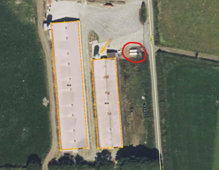
It would be good, if people validating could make the extra effort looking for the gas tanks and adding the required tags to the landuse accordingly. Most of these farms seem to be quite recent development, i.e. they’re not on the Esri Clarity imagery (c.2016).
2 Comments
janspan · 31-Jan-2024 at 18:43
Why are openstreetmap members allowed to use the task manager for personal gain.
I though the point of OPEN streetmap Ireland is that it it for everyone to help map Ireland. Not just people who want to block whole counties from being systematically mapped just so they can make a personal gain for archeological site discovery.
Anne-Karoline · 03-Mar-2024 at 21:56
The county isn’t blocked from mapping at all, you can go in with the iD editor or JOSM at any time.
Comments are closed.