The ambitious project to map all the buildings in Ireland started on November 30th 2019 in Kilkenny with the last in-person mapping event before Covid. Only we didn’t know that then.
From a mapping perspective, Covid and lockdown was probably a blessing in disguise, because it gave us something useful to do, while we were stuck at home.
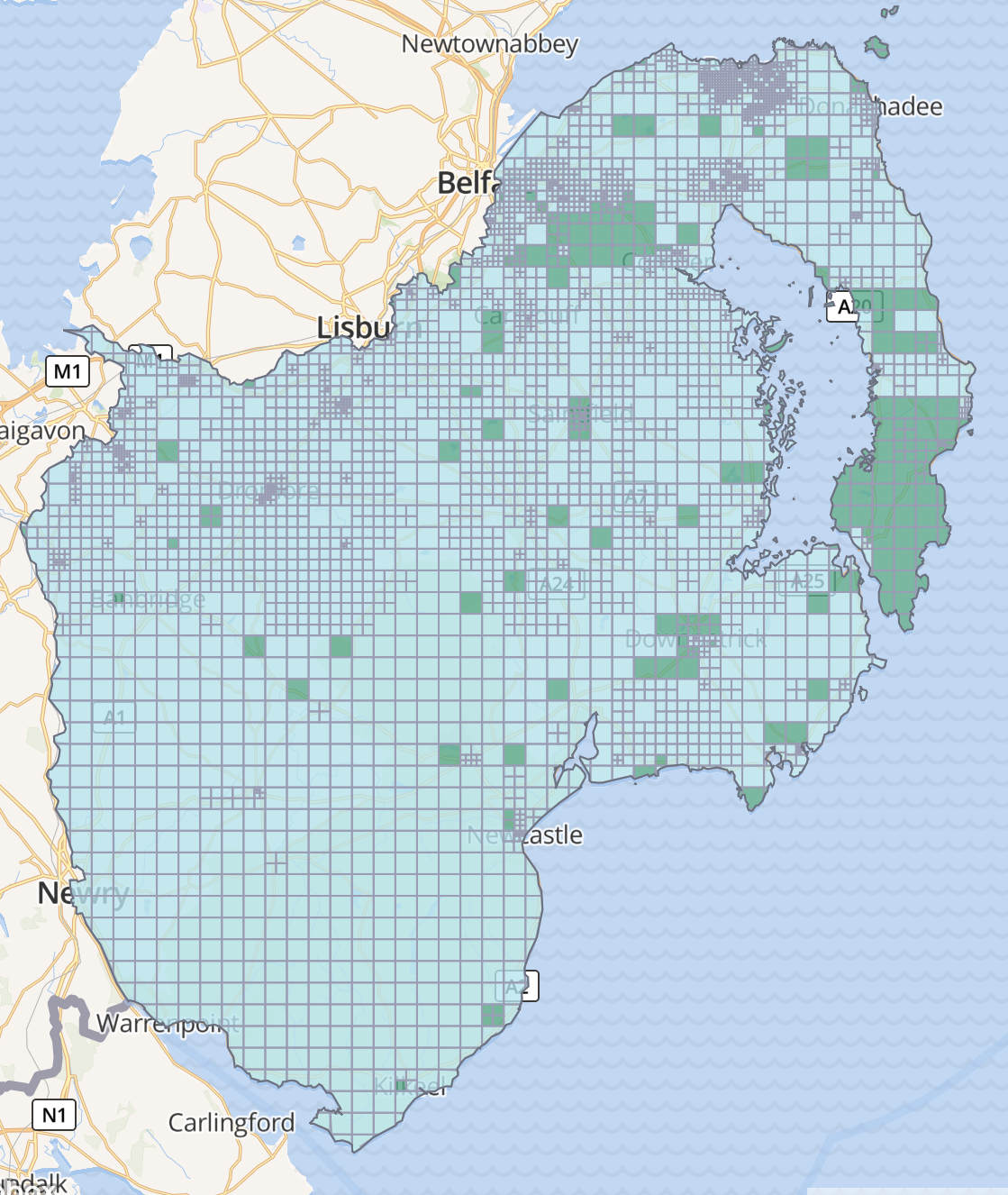
building=yes, blue is building=house etc. Source: Heigit.Completed tasks
Many tasks were completed since the beginning; the first county to be “finished” (a mapper’s work is never done) was Kilkenny in April 2020. It was followed by Co. Carlow in May 2020, Sligo in June, Waterford in September and Newry in December. During Heritage Week in 2020, we mapped Clonmel remotely and in person.
2021 saw the mapping in Co. Wexford, West Mayo, South West Kildare, Cos. Laois & Offaly, the 1st Celbridge round and Armagh city completed.
In 2022, we finished Galway city, Co. Cavan, Newry surrounds, Derry/ Londonderry and Co. Leitrim.
This year, the finished projects were: Co. Longford and Co. Roscommon in March, the 2nd round of Celbridge in May, Balbriggan in June, Co. Meath in October, Drogheda and Bray in November, Fingal in December, and b-unicycling mapped a second round of Co. Kilkenny in a private task in December (diary post).
The current projects worked on are Co. Down for mapping, and Connemara, Co. Meath, North Co. Clare, Fingal and Co. Roscommon are being validated.
It has to be said, though, that if b-unicycling aka the writer of this post wasn’t mapping full time, the progress would be much less significant.
Outlook
The validation process is becoming more and more important, when there are tasks re-activated from four years ago, when many of the housing estates now inhabited were not even visible on aerial imagery. Bing imagery seems to be the most recent in most areas, with Esri World having overtaken in some areas (like Kilkenny).
It is also reassuring to see that buildings are being mapped independently from the buildings project which was quite apparent in Fingal (read more).
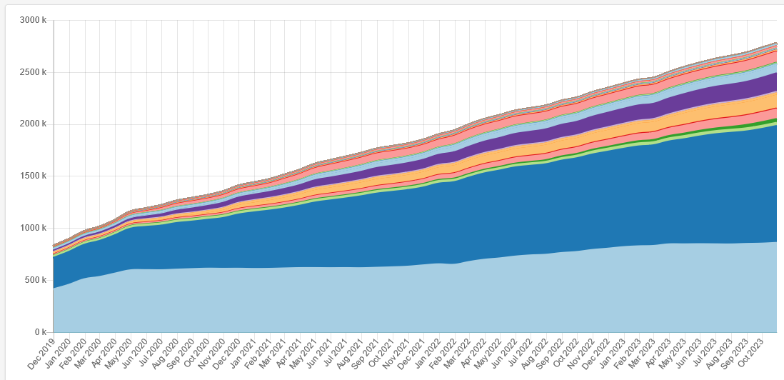
Although it seems that we are covering the whole island task by task [insert motivating graphic here ;-)], we should not forget that building and demolition works keep going on and that we should revisit every task ever so often or at least keep our own neighbourhood up to date. However, that will neglect areas which are also being neglected by other map providers – the task manager is really a more democratic approach, even if we might be biased in activating tasks.