(Co-written by AKD and JMcC)
2022 was yet another very active year for OpenStreetMap Ireland.
osmIRL buildings
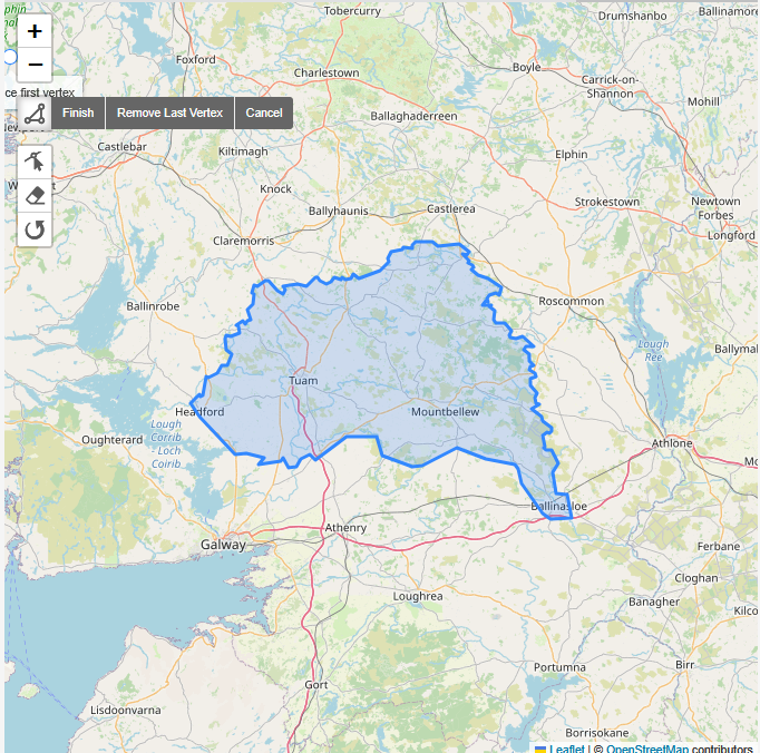
The buildings project was started in November 2019 and seeks to map all the buildings on the island of Ireland eventually. Even though the number of contributors seems to have diminished since the start, a hard core of mappers is still keeping the progress going.
Some of the larger tasks finished this year were:
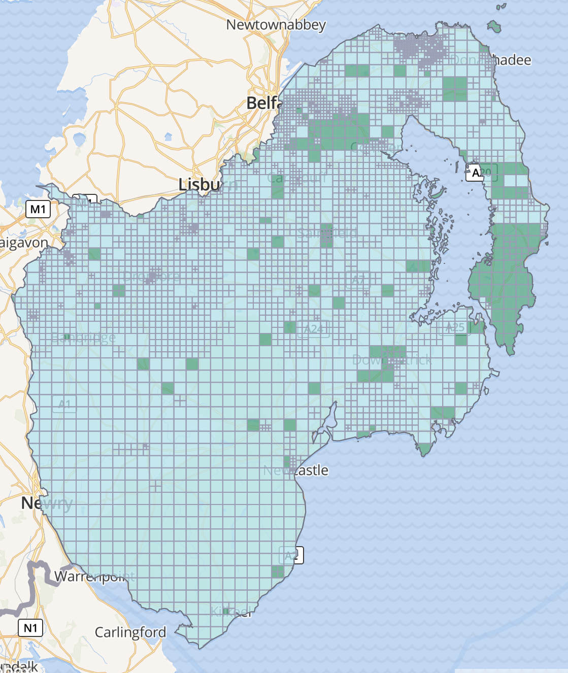
Dublin North is nearly finished, and most of the above tasks are still needing validation, especially with the new Bing (very clear) and Maxar (less clear, but dating from about summer 2022) imagery having become available during the year.
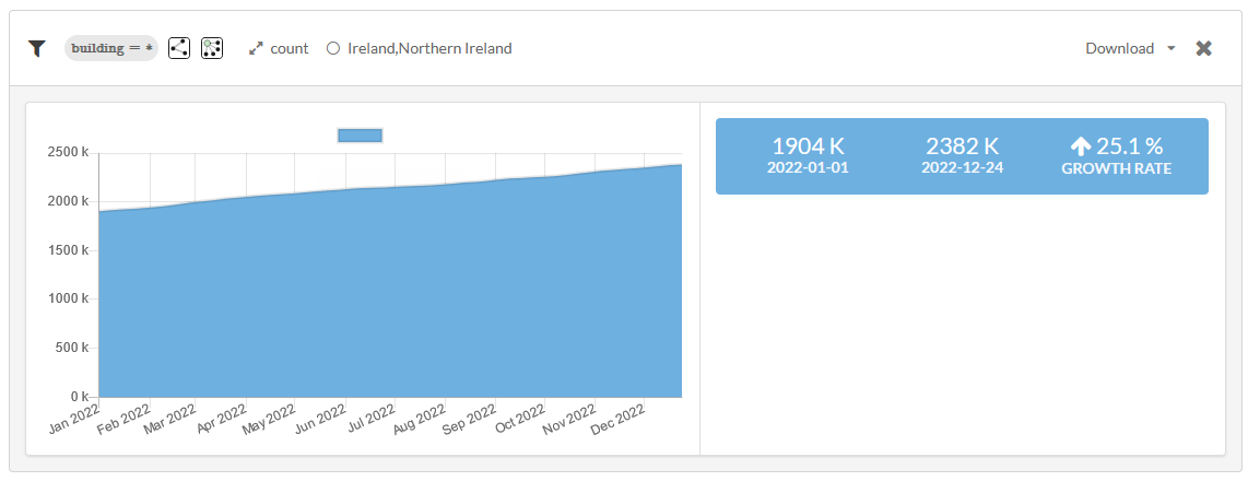
According to ohsome.org, the number of buildings on the island has increased by 478,000 this year which is a great achievement.
Of course, many other things are being mapped in the buildings project, most importantly for navigation (incl. delivery drivers), highways. Approximately 11,000 km of highways were added this year, a 5.28% increase according to ohsome.org. Not every kilometer is added during the buildings project, but it plays a major role in improving mapping infrastructure.
Mapillary
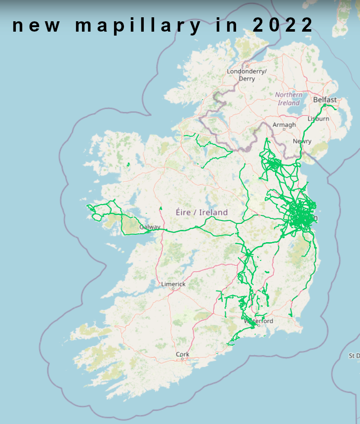
As an important source for remote mapping, mapillary deserves a mention as well. Not surprisingly considering where certain members of the community live, it reflects in the coverage of new mapillary imagery.
The top three contributors to mapillary in Ireland (all time) are debigc, dacor and yannakis with yannakis possibly being the largest contributor this year.
Unfortunately some imagery that has been contributed by others has been in ‘ingesting’ state since May.
New ways of mapping
The introduction of the new mapping app Every Door (OSM wiki) has motivated some mappers to do more in-depth or just general mapping. Others have explored the possibilities OSMAnd (OSM wiki) has to offer for mapping on the go. As with all things OSM, there is a learning curve for every app (smartphone and desktop), and most mappers embrace learning new skills and teaching others.
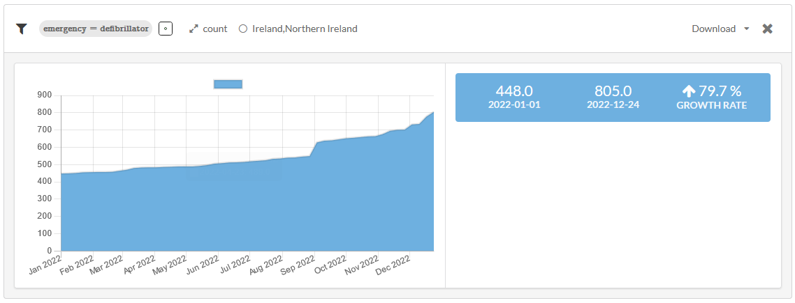
AEDs
One of the longest running projects of OSM Ireland is the mapping of AEDs (emergency=defibrillator). The collaboration with OSM Poland late in 2022 brought it to the attention of a wider audience, resulting in a surge of AEDs being mapped and re-surveyed, and maybe even more importantly, reviving the discussion about how and why to map them. Another avenue to explore are Will Fahey’s mapping efforts of AEDs.
The number of AEDs since the beginning of the year has increased by 357, an increase of nearly 80%.
Trees
A similarly impressive growth rate can be observed with the mapping of trees. (See what I did there?) Their growth rate in 2022 was 79.9%, resulting in 166,000 trees being mapped. Epicentres of tree mapping are Dublin, Kilkenny
- 4971 have their genus mapped,
- 3299 have the key genus:en added,
- 1836 have their species and 515 their species:en mapped (overlaps are likely and clean-up between species and genus necessary)
Irish language
The key name:ga was added 4,200 times to features on the island this year, a 5.2% increase.
Technical Improvements
During 2022 the technical team moved the website to a new server on Azure with a new theme.
Meetups
During 2022 OSM Ireland ran public “Map ‘n Chats” almost every month as an opportunity for beginners to improve their skills and enjoy the craic while doing so. The board also met monthly, and the AGM was held in Dublin in September.
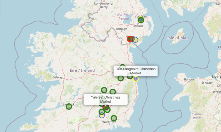
Christmas
For some fun during December a few mappers set out to map their local Christmas trees, cribs, markets and grottos.
Go raibh míle maith agaibh!
A very big thank you to all the various contributors who made Ireland’s OpenData map better this year. A lot more happened this year, of course, but most of you are in the Telegram group and were part of the changes anyway.