OpenStreetMap IrelandOpenStreetMap Ireland
  • Home
  • About
    • Membership
    • Corporate Members
    • Member Login
    • Who uses OpenStreetMap?
  • Learning
    • For Beginners
    • For Historians
      • How to fix wrong townland names spotted on townlands.ie
    • For Educators
    • For Developers
    • Tools
      • Mapillary street-level imagery
      • Panoramax Street-Level Imagery
      • OSMAnd Mobile App
      • Visualising Your Contributions
      • Using overpass-turbo to extract data from OpenStreetMap
  • Missions
    • AED Defibrillator Mapping
    • Current Mission Tasks
    • Completed Missions
      • Mapping Progress per County
      • Balbriggan
      • Celbridge
      • Connemara
      • County Cavan
      • County Clare – North
      • County Donegal
      • County Leitrim
      • County Roscommon
      • Longford Town
      • #MapLesotho
      • MapPatrick 2021
      • Wild Atlantic Way
  • News
  • Léarscáil
  • Contact

March 2023

Road sign for county Roscommon
OSM Ireland Buildings

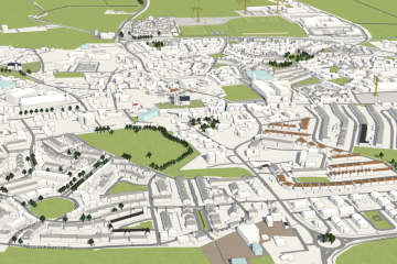
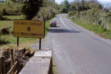
Roscommon Task Finished

March 25th 2023 saw the final touches on the Roscommon task, that is the mapping stage was completed; validation is still required. It had first been created in August of 2022, but the bulk of attention was given to it this year. Newish and clear Bing imagery was available for Read more

By Anne-Karoline, 3 years27-Mar-2023 ago
3D rendering of Lusk
Meetups

Map & Chat February: Lusk village

For our map & chat event on February 23rd, we had decided on creating a task in the taskmanager for the village of Lusk in Co. Dublin. A-Ka aka b-unicycling had chosen Lusk while she was mapping National Monuments in Ireland (read more in her diary) and noticed missing buildings Read more

By Anne-Karoline, 3 years04-Mar-2023 ago
Recent Posts
  • Map n Chat Easter 2026
  • Using Ohsome for Task Server Projects
  • Mapping Complete on County Down
  • Belfast Mapping Event
  • Belfast Mapathon
Upcoming Events (Global)
  • FOSSGIS-OSM-Communitytreffen im Linuxhotel
  • 大理三月民族节
  • Workshop: JOSM - Java OpenStreetMap Editor - Eine Einführung
  • OSM India - Monthly Online Mapathon
  • Mappando si Vinci! - 2 Maggio 2026
  • OSM-Treffpunkt
  • Braunschweiger Mappertreffen im Stratum 0 Hackerspace
OSM for History Buffs
  • A map of holy wells associated with female saints
  • Adding architectural data to a Wikidata item for a Historic Building
  • Creating a Wikidata item for a Historic Building
  • What is earth mortar and how can I record it using open data?
  • Michael Ring Blacksmith Gravestone #history #1798
Forum Discussions
  • Validating phone numbers in Ireland
  • Mangled ref:name from import
  • [SOLVED] How would this Click and Collect be tagged?
  • New Tasking Manager project: Add Missing Buildings in Ballybricken, Ireland
  • Richmond Hill in Cork city

OpenStreetMap Ireland Company Limited Registered company number 638034

General
  • Log in
  • Entries feed
  • Comments feed
  • WordPress.org
Categories
Archives

  • Home
  • About
  • Learning
  • Missions
  • News
  • Léarscáil
  • Contact
Hestia | Developed by ThemeIsle

OpenStreetMap Ireland Cookies Policy

Our Website uses cookies to improve your experience. Please visit our Privacy Policy page for more information about cookies and how we use them.

Close