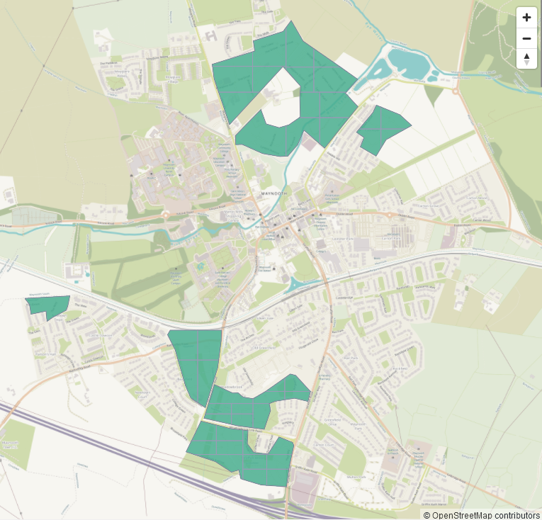
For our map & chat on April 4th, we decided to put some work into missing buildings in Maynooth, because many new housing estates had been built since we worked on Kildare, and there was new, good Bing imagery.
A task was created for the task manager with the newly built areas identified from satellite imagery. It turned out later that there were quite a few more housing estates, but they were also mapped in the aftermath of the map & chat.
Three people joined the chat and in mapping the task: jonnymccullagh, b-unicycling and TSFX. Eireidum had mapped one tile before the map & chat. The task was nearly completed after the map & chat, but we continued on mapping and then quickly validating.
Building increase
| building type | no. before map & chat | no. after completion |
|---|---|---|
building | ~3,900 | 5,850 |
yes | ~1,000 | 954 |
house | ~2,100 | 3973 |
detached | 51 | 51 |
terrace | 7 | 7 |
construction | 30 | 74 |
shed | 19 | 139 |
garage | 3 | 24 |
greenhouse | 2 | 2 |
school | 12 | 12 |
church | 3 | 3 |
hospital | 0 | 01 |
public | 8 | 8 |
commercial | 2 | 2 |
bank | 0 | 02 |
industrial | 5 | 5 |
retail | 37 | 39 |
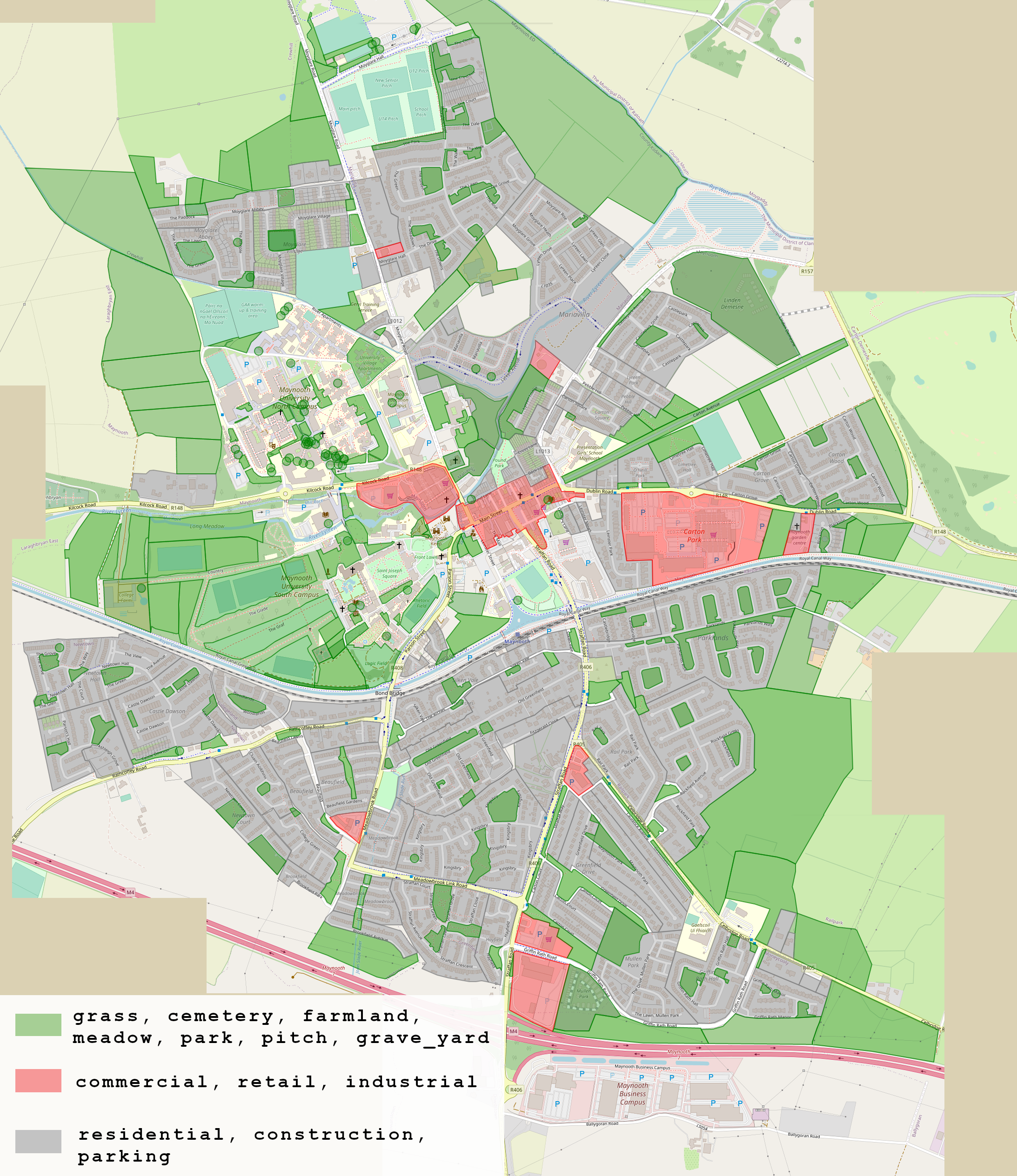
Landuses
With new housing estates, the landuses change (from farmland to construction and then residential, grass and amenity=parking), and new ones are created.
| landuse/ landcover | before map & chat (in km2) | after completion (in km2) |
|---|---|---|
residential | 2.4 | 2.446 |
construction | 0.184 | 0.992 |
grass | 0.542 | 0.534 |
commercial | 0.030 | 0.031 |
cemetery | 0.0025 | 0.0025 |
amenity=grave_yard | 0.0021 | 0.0021 |
landuse=religious | 0.0025 | 0.0024 |
amenity=school | 0.039 | 0.042 |
amenity=parking | 0.171 | 0.176 |
leisure=park | 0.059 | 0.058 |
leisure=pitch | 0.182 | 0.181 |
Highways
With new housing development come new highways, residential, service and footway being the most common. It is encouraging to see that permeability for pedestrians and cyclists is being given more attention in more recent developments.
| highway type | length before map & chat (in km) | length now (in km) |
|---|---|---|
residential | 47.9 | 48.2 |
service | 26.4 | 27.7 |
footway | 32.3 | 33 |
path | 4 | 4.9 |
construction | 0.586 | 0.532 |
What’s left to do?
As you can see from the buildings table, there is still some work to be done terracing houses and retagging building=yes to more detailed tags (overpass query for building=yes). There is also still the odd building with crooked geometry where inexperienced mappers did not square them.
People in or visiting Maynooth could help adding house numbers using the apps EveryDoor or StreetComplete.