OpenStreetMap IrelandOpenStreetMap Ireland
  • Home
  • About
    • Membership
    • Corporate Members
    • Member Login
  • Learning
    • For Beginners
    • For Historians
    • For Educators
    • For Developers
    • Tools
      • Mapillary
      • OSMAnd Mobile App
      • Visualising Your Contributions
  • Missions
    • AED Defibrillator Mapping
    • #MapLesotho
    • MapPatrick 2021
    • Wild Atlantic Way
    • All Mission Tasks
  • News
  • Contact

Wild Atlantic Way mapping

Open Data

Donegal task near completion

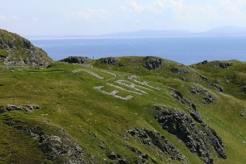
The mapping task for Co. Donegal as part of our ongoing #osmIRL_buildings campaign is very nearly finished. The task had been one of the first to be created at the start of the campaign in November 2019. However, it soon became clear that having too many tasks to choose from Read more…
By Anne-Karoline, 3 months16-Nov-2022 ago
Wild Atlantic Way mapping

Add elements to the Wild Atlantic Way relation using iD

Surveying in Co. Cork has shown that there is not one route; but rather certain towns and villages are part of the Wild Atlantic Way (WAW). There seem to be routes for drivers, motorcyclists, caravan users etc. We will try to add those roads signposted with the blue zigzag line Read more…

By Anne-Karoline, 2 years02-Jun-2021 ago
Wild Atlantic Way mapping

Adding to the Wild Atlantic Way relation using JOSM

Open JOSM. In overpass-turbo, search for “name”~”Wild Atlantic Way” and change the output file to xml ([out:xml]) or click here to open the query. The Wild Atlantic Way (WAW) has been split into sections so as not to go over the 2000 suggested member limit on relations. So the sections Read more…

By Anne-Karoline, 2 years24-May-2021 ago
Wild Atlantic Way mapping

Mapping the Wild Atlantic Way

On May 10th, travel outside your county becomes possible due to a lowering of the Covid-19 alert level in the Republic. OpenStreetMap Ireland CLG directors are so pleased with this news that we are going to organise a very special mapping campaign, like none before. With Ireland opening up a Read more…

By debigc, 2 years09-May-2021 ago
Recent Posts
  • A look back at 2022
  • Armchair archaeologist locates unknown crannógs
  • Cavan task complete
  • Christmas 2022 Challenge
  • Crannogs Discovered in County Cavan
Upcoming Events (Global)
  • Réunion du groupe local Pays Basque et Sud-Landes
  • OSM-Stammtisch Hannover
  • MapRoulette Monthly Community Meeting
  • OSMF Engineering Working Group meeting
  • Mapathon CartONG
  • Missing Maps London Mapathon
  • Stuttgarter Stammtisch
OSM for History Buffs
  • Etymology and Wikidata on OpenStreetMap (Freshford & Johnstown)
  • Add CCTV using EveryDoor
  • Finding Etymology on OpenStreetMap
  • Activate free OSMAnd Live updates #short
  • Etymology of Townland names

OpenStreetMap Ireland Company Limited Registered company number 638034

General
  • Log in
  • Entries feed
  • Comments feed
  • WordPress.org
Categories
Archives

  • Home
  • About
  • Learning
  • Missions
  • News
  • Contact
Hestia | Developed by ThemeIsle

OpenStreetMap Ireland Cookies Policy

Our Website uses cookies to improve your experience. Please visit our Privacy Policy page for more information about cookies and how we use them.

Close