2021 was a busy year for OpenStreetMap Ireland. With the primary focuses being the OSMF Microgrant project and OSM Ireland Buildings project it was supporting.
OSMF Microgrant
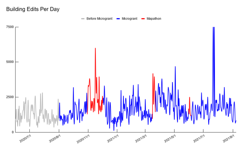
We received just shy of €2000 in September of 2020 from the OpenStreetMap Foundation (OSMF). With the project running for one calendar year, so ending in September 2021. The full application can be found here.
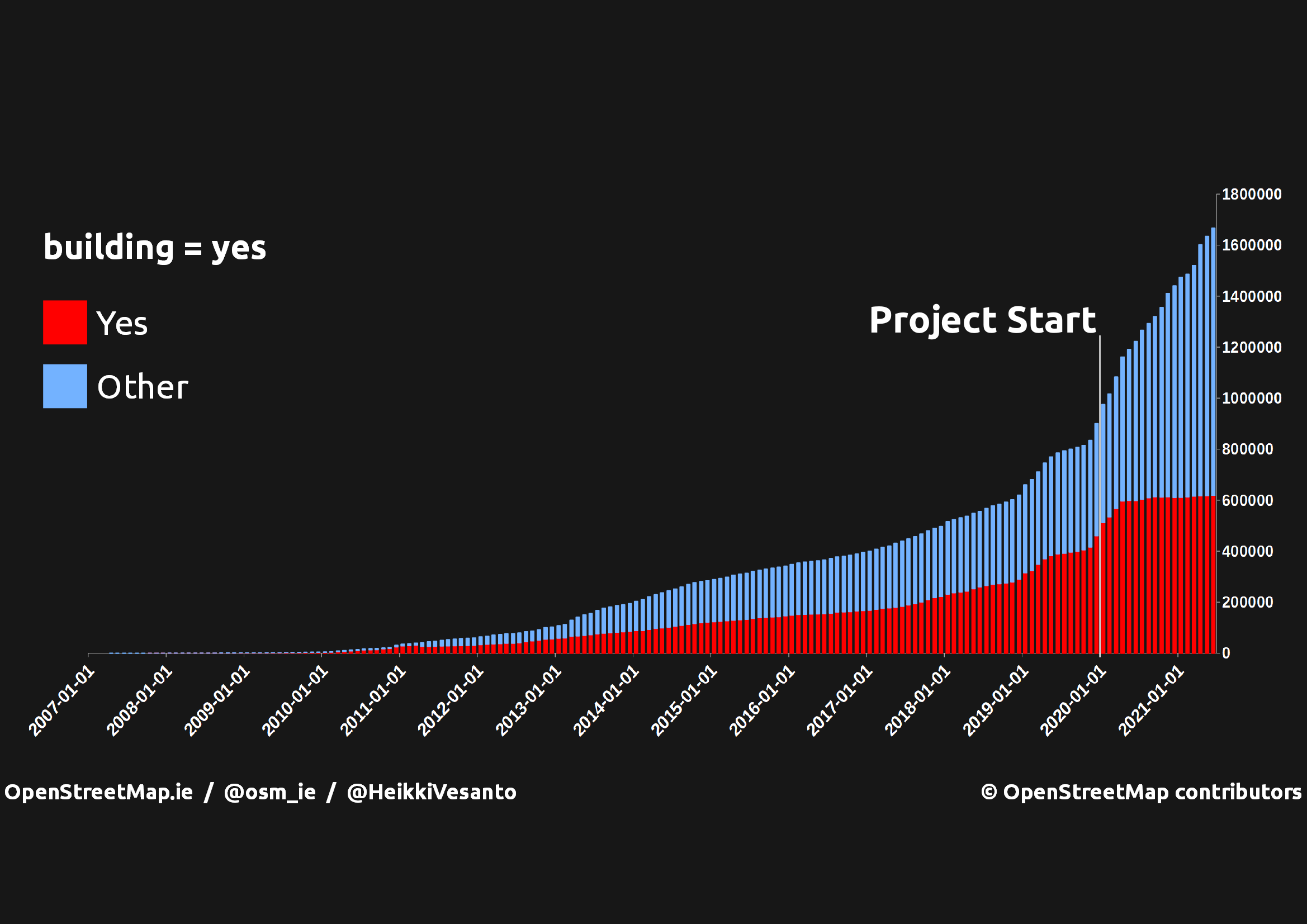
1,666,328 buildings have been mapped so far in Ireland, with 701,678 added since the start of the project, with an additional 120,356 edited.
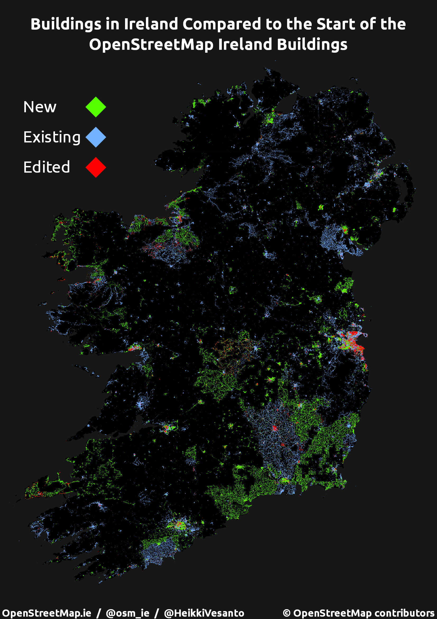
The contributions have had a spatial distribution, with certain areas with more active mappers being more extensively mapped. However there has been activity all around Ireland. Our mapping events as well have focused on areas with less contributions.
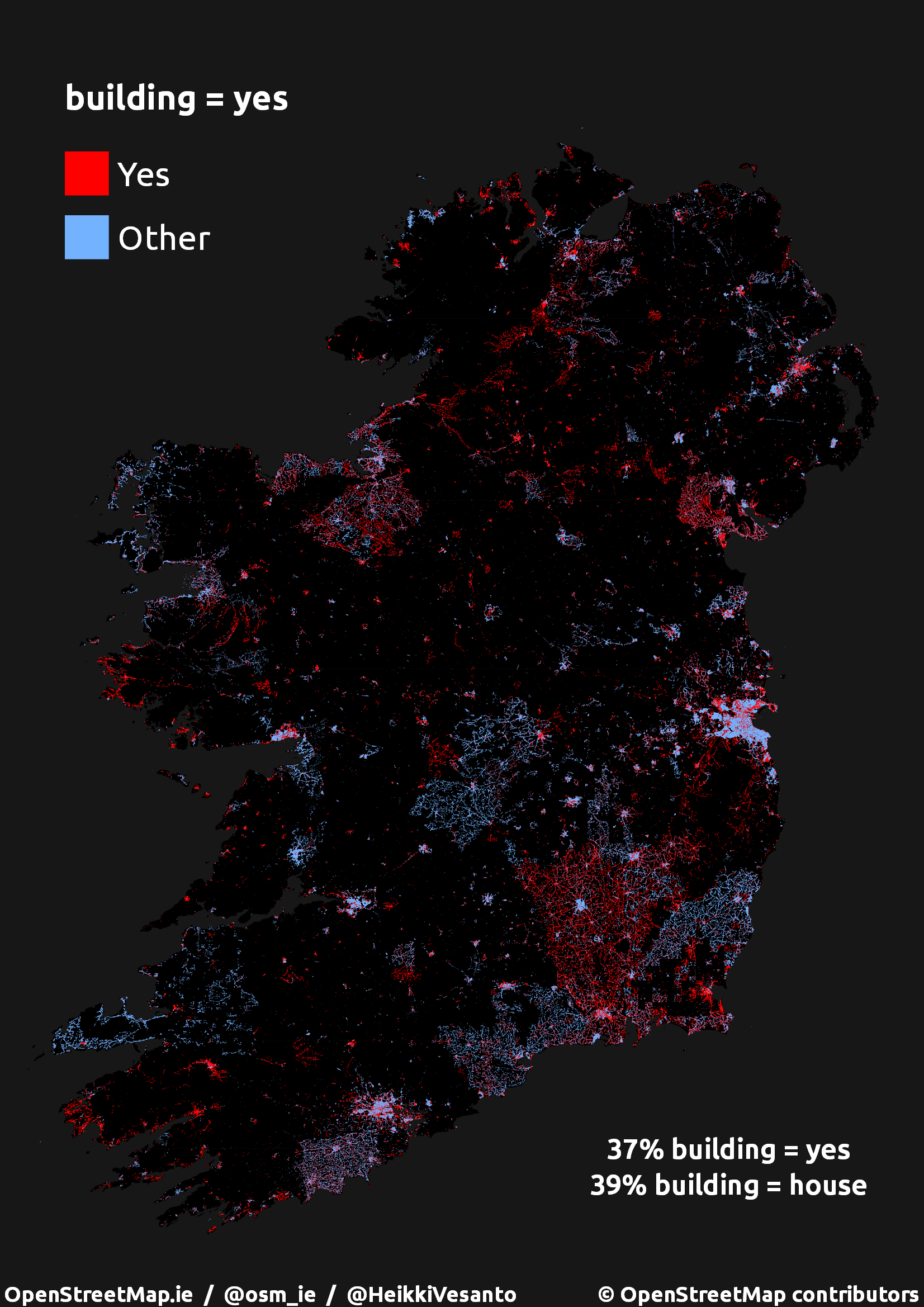
The rate of contribution increased significantly once the project was initiated and the quality of the tagging has also improved. With the bulk of the additions being more detailed than a simple building=yes. The tag building=house has even surpassed building=yes as the most common building tag.
The community in Ireland ran three mapathons during the course of the microgrant to promote awareness of the project and foster the community. The events were run online and covered a range of mapping tasks, but with a primary focus on mapping buildings. The events generally had very good participation from the community with clear increases in building mapping activity.
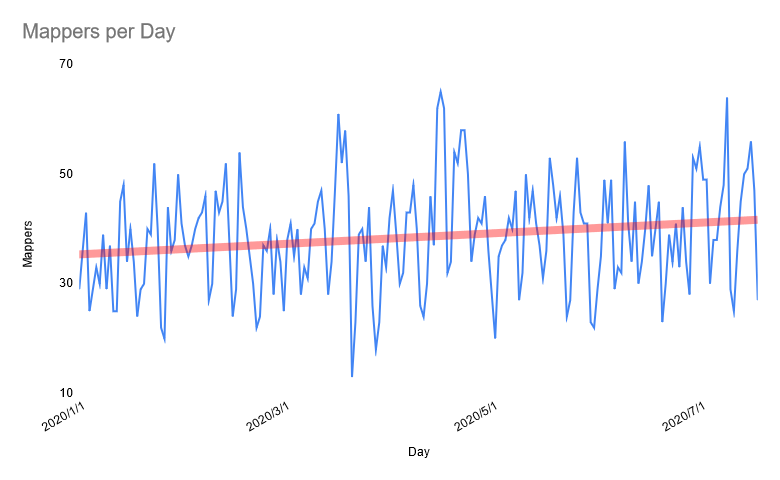
The average number of mappers also increased, however this increase was not significant.
The full Microgrant report can be found here, and we received a good review from the OSMF review board.
OSM Ireland Buildings
652,631 buildings were mapped on in Ireland over the course of 2021. Bringing the total to over 1.9 million.
Here is those buildings as they were added:
There is still plenty of opportunity to still get involve. See our tasking manager for more details.
Goals for 2022:
Map Services
- Bring back maps.openstreetmap.ie
- Engage the community for other required resources
Website
- New WordPress theme
- More video tutorials
- How to register/login
- Your first building
- Leaflet.js for web developers
- Create better guidance to engage mappers:
- Targeting specific interests (derelict buildings, farmers, etc..)
- Reengaging old mappers
Events
- Research Meetup as a platform for outreach
- Quarterly or monthly online map along organised on eventbrite or meetup.com
- Physical meetup if covid rules allow


1 Comment
Jim Lynch · 05-Jun-2022 at 09:47
Hello
There used to be a Townland Map which could be accessed on: http://dev3.openstreetmap.ie/osm/slippymap.html?zoom=7&lat=53.5&lon=-6&layers=B00FFFFFFF which no longer seems to be available. Can you help?
All the best
Jim
Comments are closed.