OpenStreetMap IrelandOpenStreetMap Ireland
  • Home
  • About
    • Membership
    • Corporate Members
    • Member Login
    • Who uses OpenStreetMap?
  • Learning
    • For Beginners
    • For Historians
      • How to fix wrong townland names spotted on townlands.ie
    • For Educators
    • For Developers
    • Tools
      • Mapillary street-level imagery
      • Panoramax Street-Level Imagery
      • OSMAnd Mobile App
      • Visualising Your Contributions
      • Using overpass-turbo to extract data from OpenStreetMap
  • Missions
    • AED Defibrillator Mapping
    • Current Mission Tasks
    • Completed Missions
      • Mapping Progress per County
      • Balbriggan
      • Celbridge
      • Connemara
      • County Cavan
      • County Clare – North
      • County Donegal
      • County Leitrim
      • County Roscommon
      • Longford Town
      • #MapLesotho
      • MapPatrick 2021
      • Wild Atlantic Way
  • News
  • LĂ©arscáil
  • Contact

urban mapping

OSM Ireland Buildings

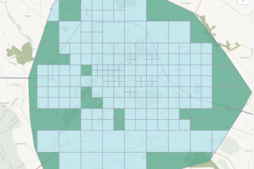
Longford Town Task Finished

The Longford town task had been created in 2020, but was then “parked”, because the large choice of tasks hindered the completion of any of them. It was revived after the completion of the Roscommon task and finished within less than a week. The best quality imagery was Esri Clarity Read more

By Anne-Karoline, 3 years06-Apr-2023 ago
Recent Posts
  • North Co. Galway task mapping finished
  • North Co. Clare validation complete!
  • Townland boundary overpass links
  • OpenStreetMap Ireland Annual General Meeting
  • OSM 21st Birthday Online Mapathon
Upcoming Events (Global)
  • FOSS4G International Conference 2025 - Auckland
  • Internationale GeoWeek - Online Mapathon von Ă„RZTE OHNE GRENZEN (AT/CH/DE)
  • Unibo Mapathon OpenStreetMap 2025
  • OSM tĂ©rkĂ©pest 2025-11-18
  • Missing Maps London: (Online) Mid-Month Mapathon [eng]
  • RĂ©union du groupe local de Lyon
  • 194. OSM-Stammtisch Bonn
OSM for History Buffs
  • Extracting data from OpenStreetMap
  • Rathvilly ogham stone 3D print timelapse
  • Recognising and mapping coffin rests
  • Using historic Ordnance Survey maps for research #OpenData #NLS
  • Kenny's Well Fish #folklore #holywell
Forum Discussions
  • Ryder Cup temporary constructions
  • Ireland - Inconsistent Layer Tagging on Highways & Spiky Land Use
  • Broken boundaries (September 2025 Edition)
  • OpenStreetMap Ireland Annual General Meeting 2025
  • Northern Ireland county vs new council boundaries

OpenStreetMap Ireland Company Limited Registered company number 638034

General
  • Log in
  • Entries feed
  • Comments feed
  • WordPress.org
Categories
Archives

  • Home
  • About
  • Learning
  • Missions
  • News
  • LĂ©arscáil
  • Contact
Hestia | Developed by ThemeIsle

OpenStreetMap Ireland Cookies Policy

Our Website uses cookies to improve your experience. Please visit our Privacy Policy page for more information about cookies and how we use them.

Close