OpenStreetMap IrelandOpenStreetMap Ireland
  • Home
  • About
    • Membership
    • Corporate Members
    • Member Login
    • Who uses OpenStreetMap?
  • Learning
    • For Beginners
    • For Historians
      • How to fix wrong townland names spotted on townlands.ie
    • For Educators
    • For Developers
    • Tools
      • Mapillary street-level imagery
      • Panoramax Street-Level Imagery
      • OSMAnd Mobile App
      • Visualising Your Contributions
      • Using overpass-turbo to extract data from OpenStreetMap
  • Missions
    • AED Defibrillator Mapping
    • Current Mission Tasks
    • Completed Missions
      • Mapping Progress per County
      • Balbriggan
      • Celbridge
      • Connemara
      • County Cavan
      • County Clare – North
      • County Donegal
      • County Leitrim
      • County Roscommon
      • Longford Town
      • #MapLesotho
      • MapPatrick 2021
      • Wild Atlantic Way
  • News
  • Léarscáil
  • Contact

Longford

OSM Ireland Buildings

Longford Town Task Finished

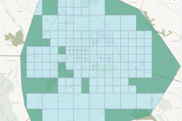
The Longford town task had been created in 2020, but was then “parked”, because the large choice of tasks hindered the completion of any of them. It was revived after the completion of the Roscommon task and finished within less than a week. The best quality imagery was Esri Clarity Read more

By Anne-Karoline, 3 years06-Apr-2023 ago
Recent Posts
  • Map n Chat Easter 2026
  • Using Ohsome for Task Server Projects
  • Mapping Complete on County Down
  • Belfast Mapping Event
  • Belfast Mapathon
Upcoming Events (Global)
  • Webinaire de sensibilisation à OpenStreetMap pour les collectivités
  • Mappy Hour OSM España
  • Missing Maps London Mid-Month (Without Training) Advanced Mappers [eng]
  • Missing Maps London In-Person Mapathon
  • Réunion du groupe local de Lyon
  • 200. OSM-Stammtisch Bonn
  • East Midlands pub meet-up
OSM for History Buffs
  • 15 Things to Map on a Hike with EveryDoor
  • 15 Things to Map on a Hike
  • A map of holy wells associated with female saints
  • Adding architectural data to a Wikidata item for a Historic Building
  • Creating a Wikidata item for a Historic Building
Forum Discussions
  • Power - Part of Ørsted is now Perigus Energy
  • Validating phone numbers in Ireland
  • Mangled ref:name from import
  • [SOLVED] How would this Click and Collect be tagged?
  • New Tasking Manager project: Add Missing Buildings in Ballybricken, Ireland

OpenStreetMap Ireland Company Limited Registered company number 638034

General
  • Log in
  • Entries feed
  • Comments feed
  • WordPress.org
Categories
Archives

  • Home
  • About
  • Learning
  • Missions
  • News
  • Léarscáil
  • Contact
Hestia | Developed by ThemeIsle

OpenStreetMap Ireland Cookies Policy

Our Website uses cookies to improve your experience. Please visit our Privacy Policy page for more information about cookies and how we use them.

Close