OpenStreetMap IrelandOpenStreetMap Ireland
  • Home
  • About
    • Membership
    • Corporate Members
    • Member Login
    • Who uses OpenStreetMap?
  • Learning
    • For Beginners
    • For Historians
      • How to fix wrong townland names spotted on townlands.ie
    • For Educators
    • For Developers
    • Tools
      • Mapillary street-level imagery
      • Panoramax Street-Level Imagery
      • OSMAnd Mobile App
      • Visualising Your Contributions
      • Using overpass-turbo to extract data from OpenStreetMap
  • Missions
    • AED Defibrillator Mapping
    • Current Mission Tasks
    • Completed Missions
      • Mapping Progress per County
      • Balbriggan
      • Celbridge
      • Connemara
      • County Cavan
      • County Clare – North
      • County Donegal
      • County Leitrim
      • County Roscommon
      • Longford Town
      • #MapLesotho
      • MapPatrick 2021
      • Wild Atlantic Way
  • News
  • LĂ©arscáil
  • Contact

Kildare

Meetups

Map & Chat April: Maynooth

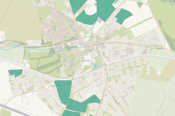
For our map & chat on April 4th, we decided to put some work into missing buildings in Maynooth, because many new housing estates had been built since we worked on Kildare, and there was new, good Bing imagery. A task was created for the task manager with the newly Read more

By Anne-Karoline, 2 years11-Apr-2023 ago
Recent Posts
  • North Co. Galway task mapping finished
  • North Co. Clare validation complete!
  • Townland boundary overpass links
  • OpenStreetMap Ireland Annual General Meeting
  • OSM 21st Birthday Online Mapathon
Upcoming Events (Global)
  • MapatĂłn Nacional de MĂ©xico 2025
  • Missing Maps London: (Online) Mid-Month Mapathon [eng]
  • RĂ©union du groupe local de Lyon
  • 192. OSM-Stammtisch Bonn
  • LĂĽneburger Mappertreffen
  • Jornadas de SIG Libre
  • Mapping Party Semanal LATAM | Weekly LATAM Mapping Party
OSM for History Buffs
  • Building a chamfer stop database on uMap
  • Inistioge Cloister Reconstruction
  • Medieval grave slab discovered #medieval #kilkenny
  • St Brigid's Well, Ballintubbert (Co. Laois)
  • Holy wells and OpenData - a talk about Wikidata et al.
Forum Discussions
  • Broken boundaries (September 2025 Edition)
  • OpenStreetMap Ireland Annual General Meeting 2025
  • Northern Ireland county vs new council boundaries
  • N21 to N20 junction at Patrickswell, Limerick
  • NI charity numbers

OpenStreetMap Ireland Company Limited Registered company number 638034

General
  • Log in
  • Entries feed
  • Comments feed
  • WordPress.org
Categories
Archives

  • Home
  • About
  • Learning
  • Missions
  • News
  • LĂ©arscáil
  • Contact
Hestia | Developed by ThemeIsle

OpenStreetMap Ireland Cookies Policy

Our Website uses cookies to improve your experience. Please visit our Privacy Policy page for more information about cookies and how we use them.

Close