OpenStreetMap IrelandOpenStreetMap Ireland
  • Home
  • About
    • Membership
    • Corporate Members
    • Member Login
    • Who uses OpenStreetMap?
  • Learning
    • For Beginners
    • For Historians
      • How to fix wrong townland names spotted on townlands.ie
    • For Educators
    • For Developers
    • Tools
      • Mapillary street-level imagery
      • Panoramax Street-Level Imagery
      • OSMAnd Mobile App
      • Visualising Your Contributions
      • Using overpass-turbo to extract data from OpenStreetMap
  • Missions
    • AED Defibrillator Mapping
    • Current Mission Tasks
    • Completed Missions
      • Mapping Progress per County
      • Balbriggan
      • Celbridge
      • Connemara
      • County Cavan
      • County Clare – North
      • County Donegal
      • County Leitrim
      • County Roscommon
      • Longford Town
      • #MapLesotho
      • MapPatrick 2021
      • Wild Atlantic Way
  • News
  • Léarscáil
  • Contact

tree mapping

task manager Celbridge
Open Data

Celbridge Task – 2nd Round

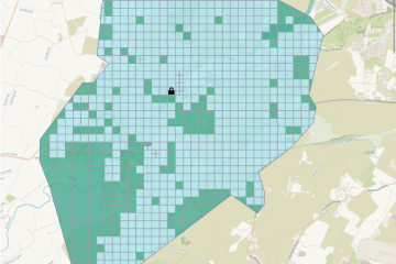
The project to map all buildings in Celbridge was an initiative by the Celbridge Community Council back in 2021. The task was finished relatively quickly due to the good participation. At the beginning of April, local resident and mapper Stephen had requested to have the Celbridge 2 task re-activated, and Read more

By Anne-Karoline, 2 years15-May-2023 ago
Recent Posts
  • OSM 21st Birthday Online Mapathon
  • OpenStreetMap Ireland online meetup – May 2025
  • Louth (minus Dundalk) Task Mapped
  • Dundalk Task Complete
  • How to fix wrong townland names spotted on townlands.ie
Upcoming Events (Global)
  • Mapatón Nacional de México 2025
  • OSM Radinfra-Mapathon #3
  • 🇧🇷 WORKSHOP MPCS 2025 + BOOK RELEASE
  • Düsseldorfer OpenStreetMap-Treffen (online)
  • [Online] OpenStreetMap Foundation board of Directors - public videomeeting
  • Mappy Hour OSM España
  • OSM-Treffen Bochum mit Workshop JOSM + Overpass-API
OSM for History Buffs
  • Inistioge Cloister Reconstruction
  • Medieval grave slab discovered #medieval #kilkenny
  • St Brigid's Well, Ballintubbert (Co. Laois)
  • Holy wells and OpenData - a talk about Wikidata et al.
  • Easily add mapillary ID to node
Forum Discussions
  • Northern Ireland county vs new council boundaries
  • N21 to N20 junction at Patrickswell, Limerick
  • NI charity numbers
  • Boundaries in Ireland
  • Mapbox organized editing, Missing Roads in Ireland

OpenStreetMap Ireland Company Limited Registered company number 638034

General
  • Log in
  • Entries feed
  • Comments feed
  • WordPress.org
Categories
Archives

  • Home
  • About
  • Learning
  • Missions
  • News
  • Léarscáil
  • Contact
Hestia | Developed by ThemeIsle

OpenStreetMap Ireland Cookies Policy

Our Website uses cookies to improve your experience. Please visit our Privacy Policy page for more information about cookies and how we use them.

Close