OpenStreetMap IrelandOpenStreetMap Ireland
  • Home
  • About
    • Membership
    • Corporate Members
    • Member Login
    • Who uses OpenStreetMap?
  • Learning
    • For Beginners
    • For Historians
      • How to fix wrong townland names spotted on townlands.ie
    • For Educators
    • For Developers
    • Tools
      • Mapillary street-level imagery
      • Panoramax Street-Level Imagery
      • OSMAnd Mobile App
      • Visualising Your Contributions
      • Using overpass-turbo to extract data from OpenStreetMap
  • Missions
    • AED Defibrillator Mapping
    • Current Mission Tasks
    • Completed Missions
      • Mapping Progress per County
      • Balbriggan
      • Celbridge
      • Connemara
      • County Cavan
      • County Clare – North
      • County Donegal
      • County Leitrim
      • County Roscommon
      • Longford Town
      • #MapLesotho
      • MapPatrick 2021
      • Wild Atlantic Way
  • News
  • LĂ©arscáil
  • Contact

Belfast Mapathon

Published by Jonny McCullagh on 22-Jan-202622-Jan-2026

A Mapathon has been organised for Saturday 21st February 2026 from 11am to 1pm with food provided at QUB Geosciences building on Elmwood Avenue behind the Student’s Union. Numbers are limited to 30 attendees.

Sign up on eventbrite here.
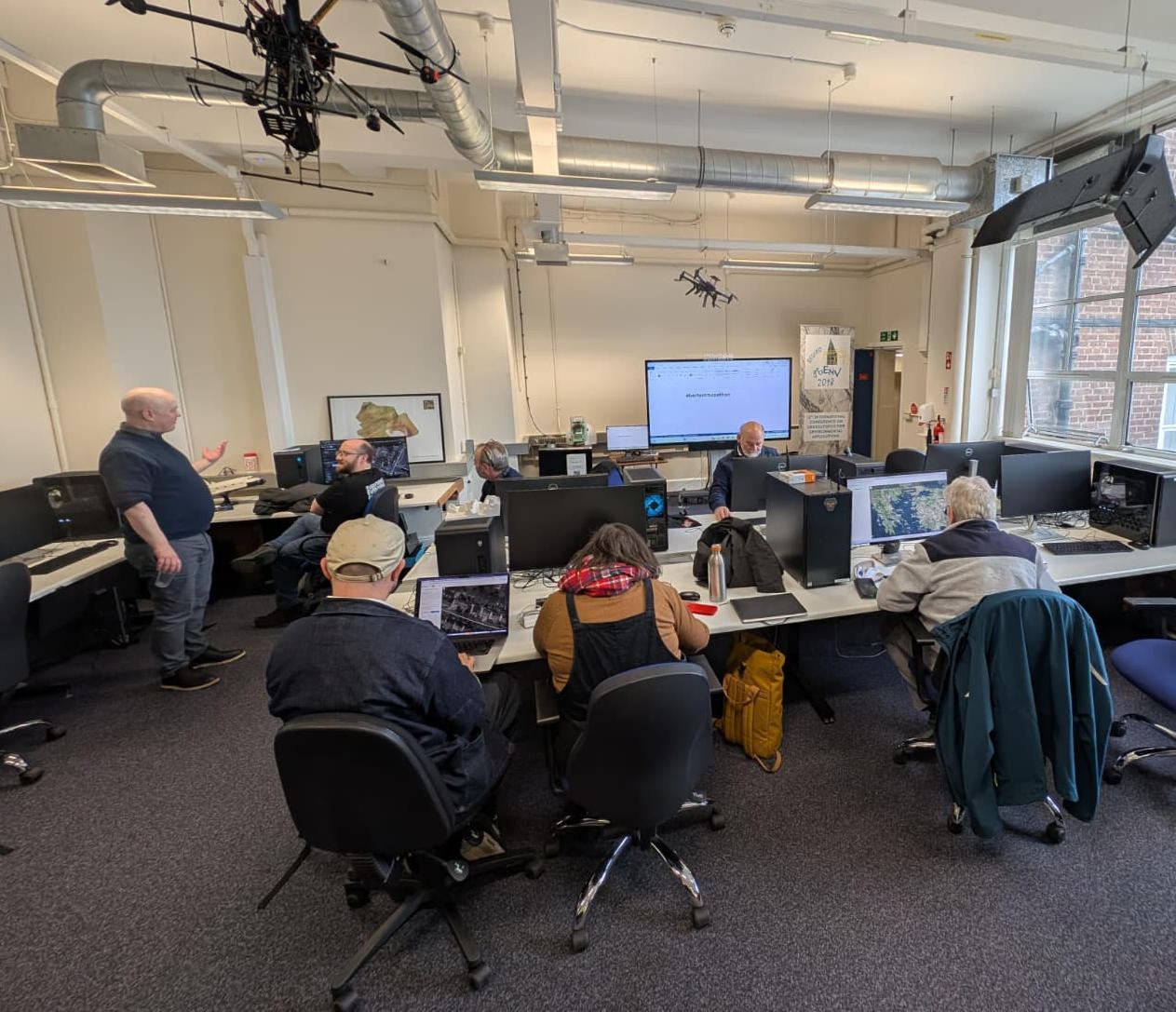
Categories: Events

0 Comments

Leave a Reply Cancel reply

Avatar placeholder

You must be logged in to post a comment.

Recent Posts
  • Belfast Mapathon
  • North Co. Galway task mapping finished
  • North Co. Clare validation complete!
  • Townland boundary overpass links
  • OpenStreetMap Ireland Annual General Meeting
Upcoming Events (Global)
  • Cartopartie - tournĂ©e Tous EGO
  • Rhein-Neckar OpenstreetMap Treffen
  • UN Mappers: OpenStreetMap Beginner Training using JOSM
  • OSMF Engineering Working Group meeting
  • OSM Bengaluru Mapping Party
  • State of the Map India 2026
  • Missing Maps : Mapathon en ligne - CartONG [fr]
OSM for History Buffs
  • Earth Mortar at Ballyellin Church #buildingsarchaeology #earthmortar
  • Creating an interactive Down Survey map for County Kilkenny on uMap 49:09
  • Recording mounting blocks on OpenStreetMap
  • Knockroe Passage Tomb Sunrise 2025-12-19
  • Making Down Survey names easier to find
Forum Discussions
  • A technical query re OSM vs. Translink's Open bus stop Data
  • BnM railways bulk edit
  • Translink's new nightbuses
  • Ireland - Disconnected Barriers from Nearby Roads
  • Ryder Cup temporary constructions

Related Posts

Events

OpenStreetMap Ireland Annual General Meeting

Date: Sat, September 20, 2025 · 12:00 Location: Digital Arts and Humanities Active Learning Space, University College Cork, T12 Y337 Online: We will cover the state of OpenStreetMap in Ireland, an update on the finances of the company Read more

Events

OSM 21st Birthday Online Mapathon

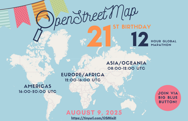
The OpenStreetMap 21st Anniversary Birthday party will be celebrated on 9th August 2025, from 1pm to 5pm Irish Time feel free to join the online meetup at: https://osmvideo.cloud68.co/user/joo-nq7-ghw

Events

OpenStreetMap Ireland online meetup – May 2025

Join us for a dive into how Large Language Models (LLMs) and an MCP (Model Context Protocol) Server can be combined to build an AI-powered chatbot that queries the OpenStreetMap (OSM) database. This session will demonstrate the working code—available on GitHub—for both the backend and frontend components.

OpenStreetMap Ireland Company Limited Registered company number 638034

General
  • Log in
  • Entries feed
  • Comments feed
  • WordPress.org
Categories
Archives

  • Home
  • About
  • Learning
  • Missions
  • News
  • LĂ©arscáil
  • Contact
Hestia | Developed by ThemeIsle

OpenStreetMap Ireland Cookies Policy

Our Website uses cookies to improve your experience. Please visit our Privacy Policy page for more information about cookies and how we use them.

Close